Wijkplannen
Antwerp, The Netherlands
Location | Antwerp, Belgium
Year | 2021 - 2026
Client | City of Antwerp
Collaboration | Witteveen+Bos Belgium, Common Ground
Status | Municipal strategy document, officially approved
In the coming years, the city of Antwerp will aim to realize the ambitions of the Waterplan (2019). The Wijkplannen Water en Groen is a translation of this citywide vision into a neighborhood application. For the districts Stadspark, Brederode and Kiel-Tentoonstelling, measures are outlined to redesign the local streets, squares and parks. By combining climate themes, a blue green netwerk is created, resulting in a multifunctional and resilient public space.
Local issues and solutions
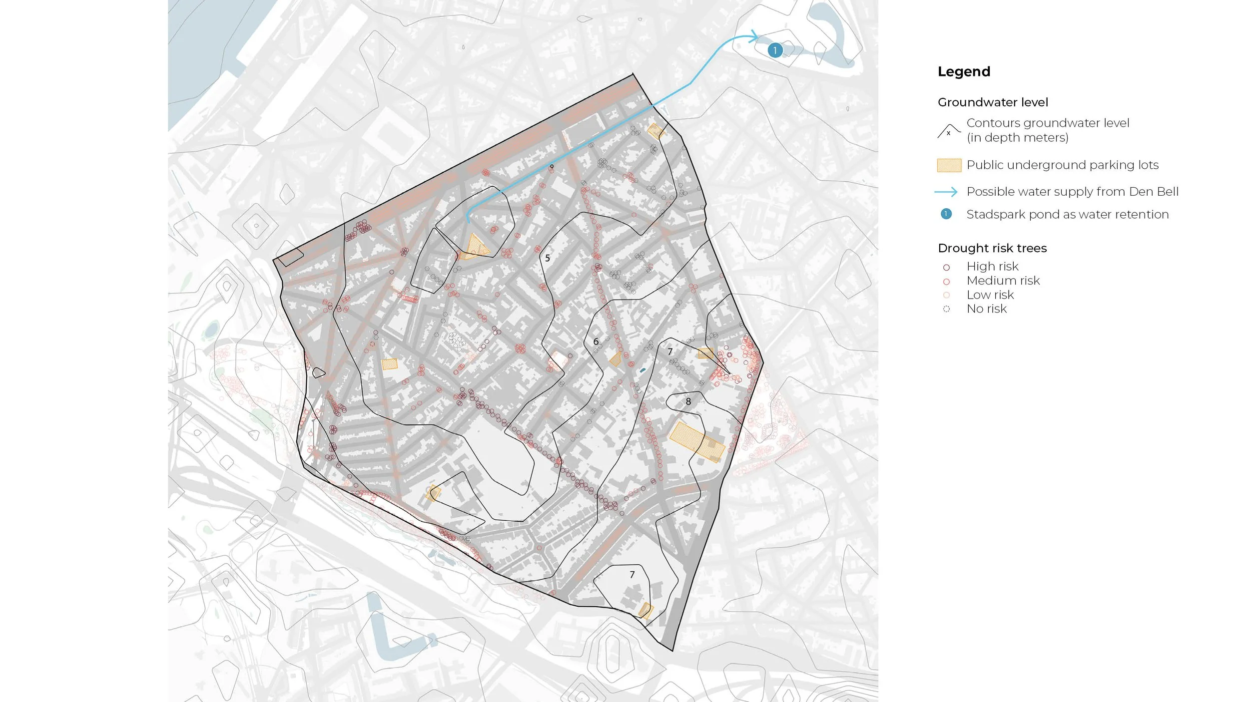
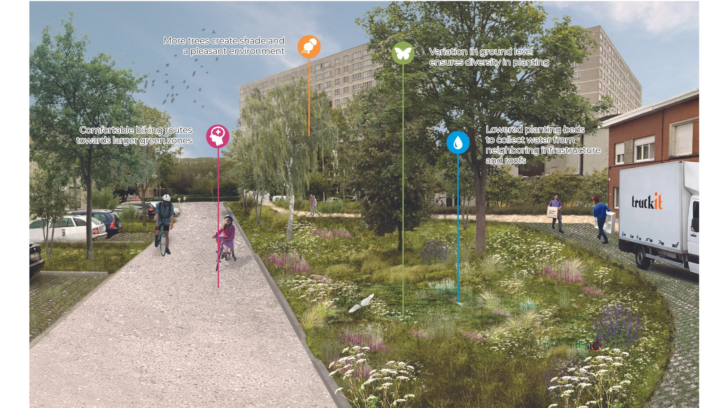
The urban design of Antwerp is vulnerable to weather extremes caused by climate change. Stadspark, Brederode and Kiel-Tentoonstelling already experience consequences like floods, drought and heat stress. An indirect effect includes ecological challenges that affect both the human and non-human inhabitants. Without a strong blue-green network, these districts are unable to face extreme weather.
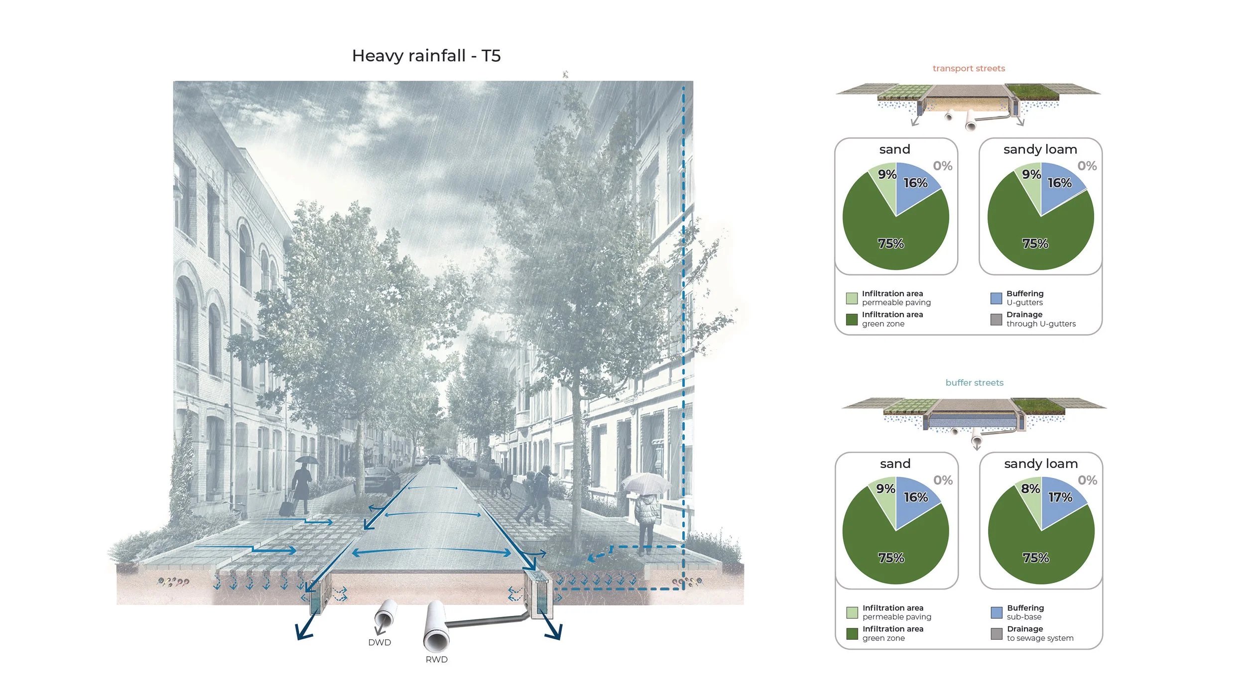
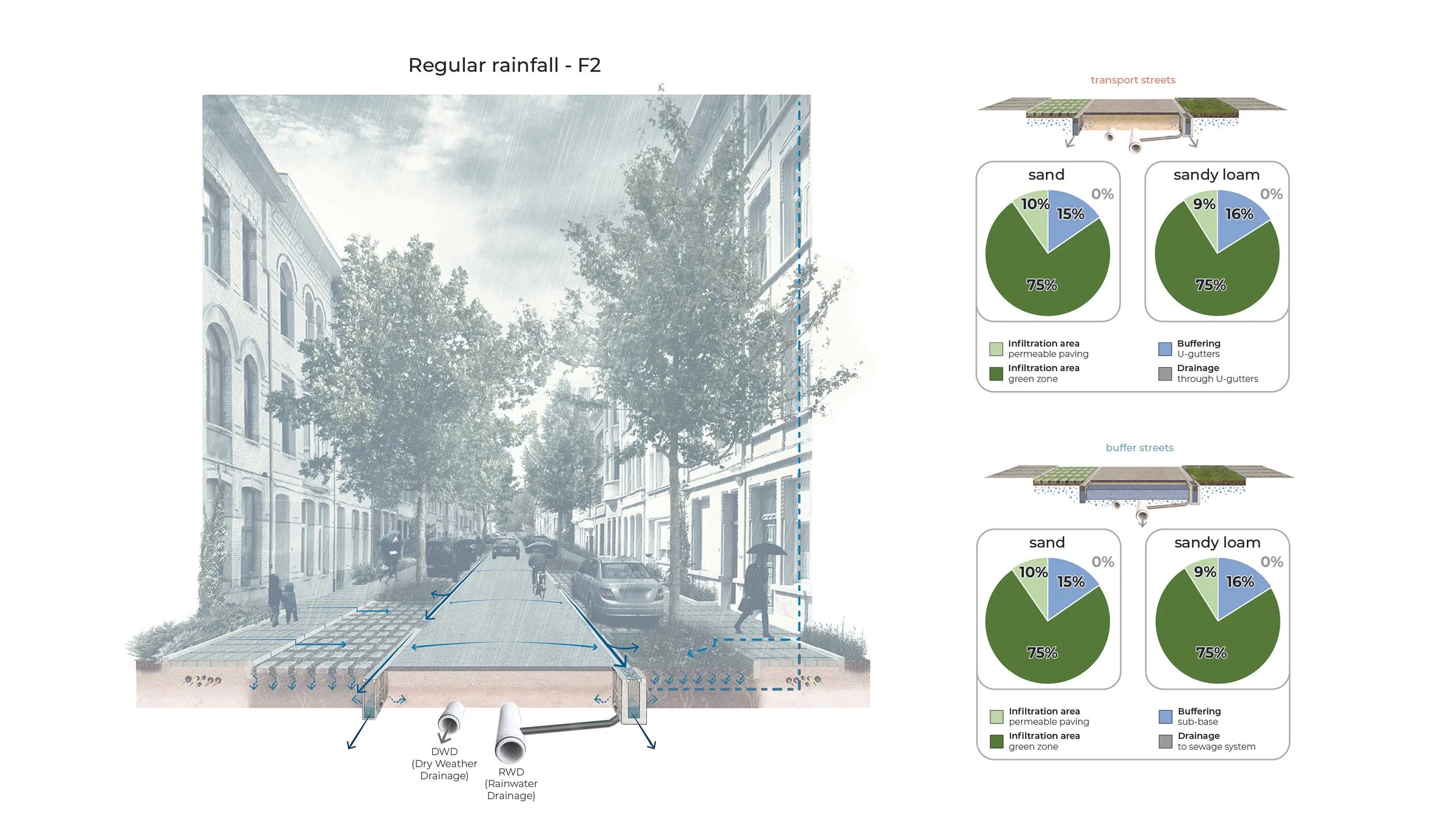
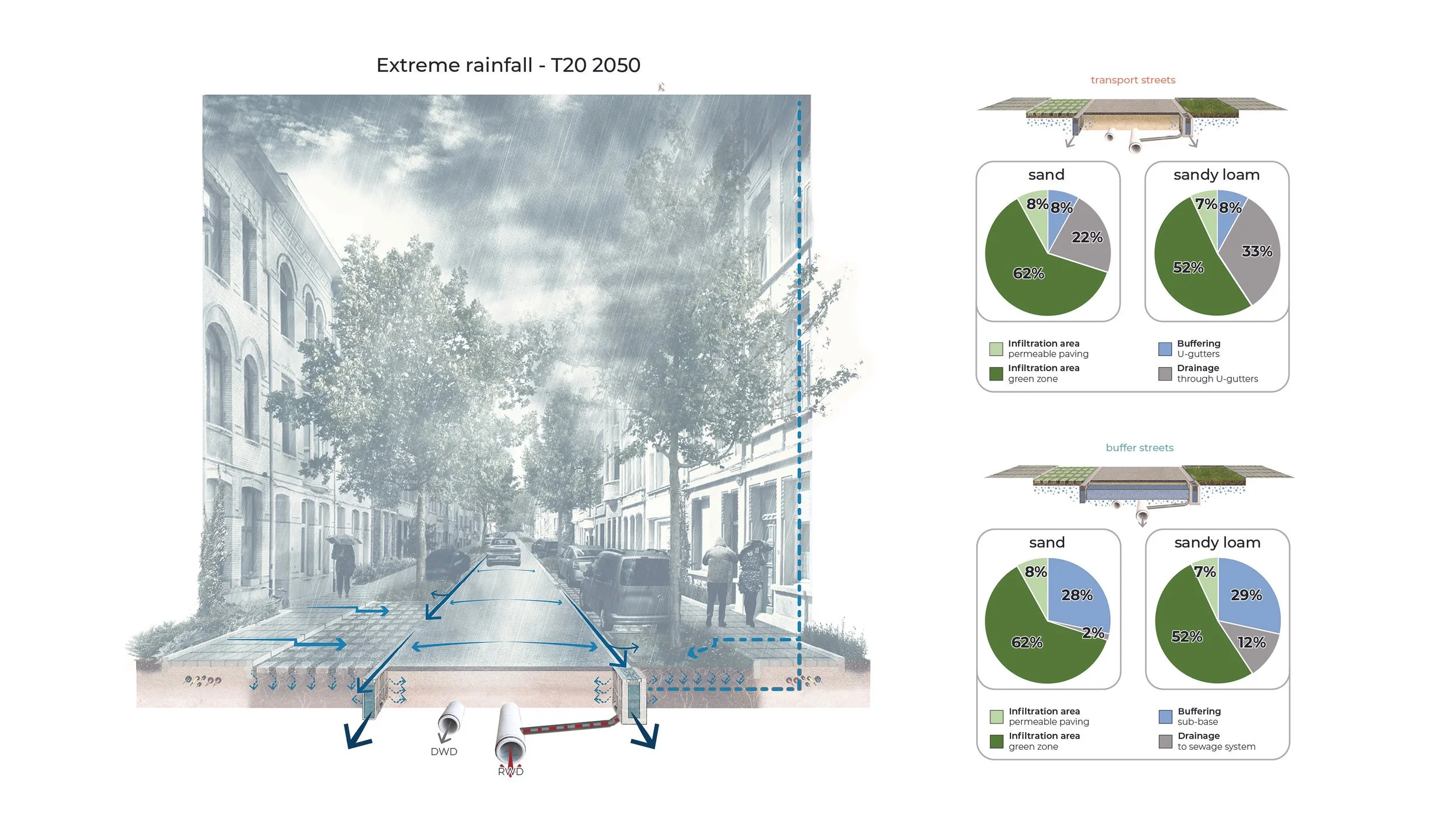
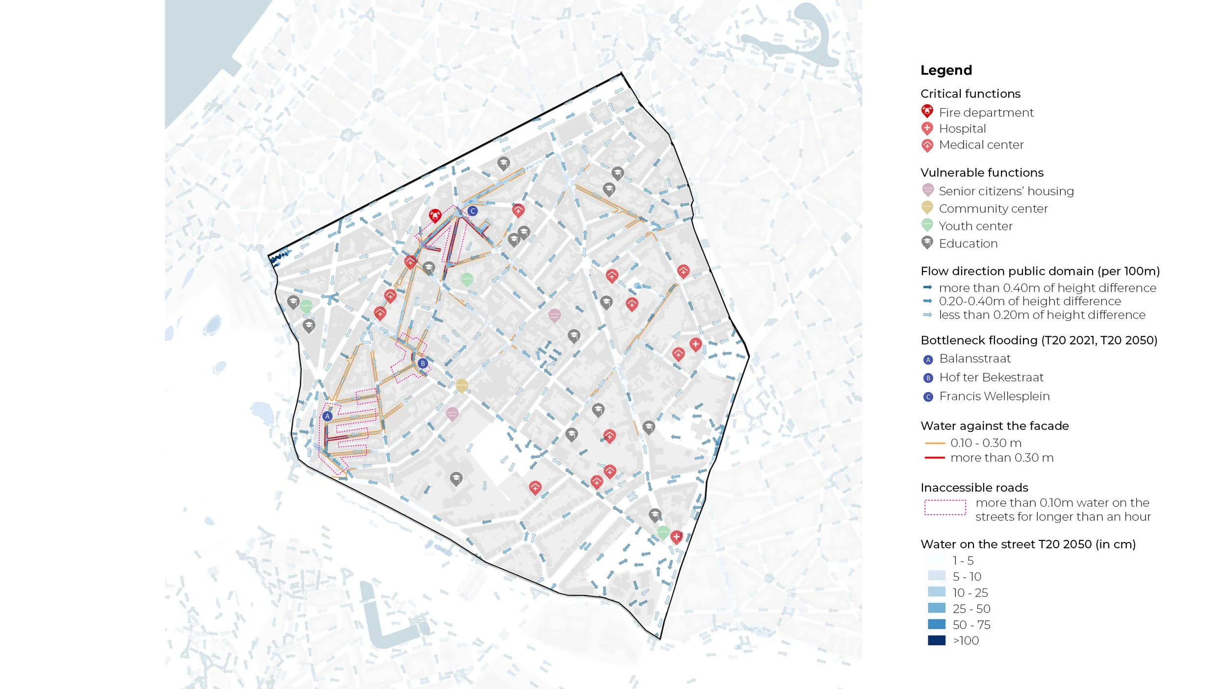
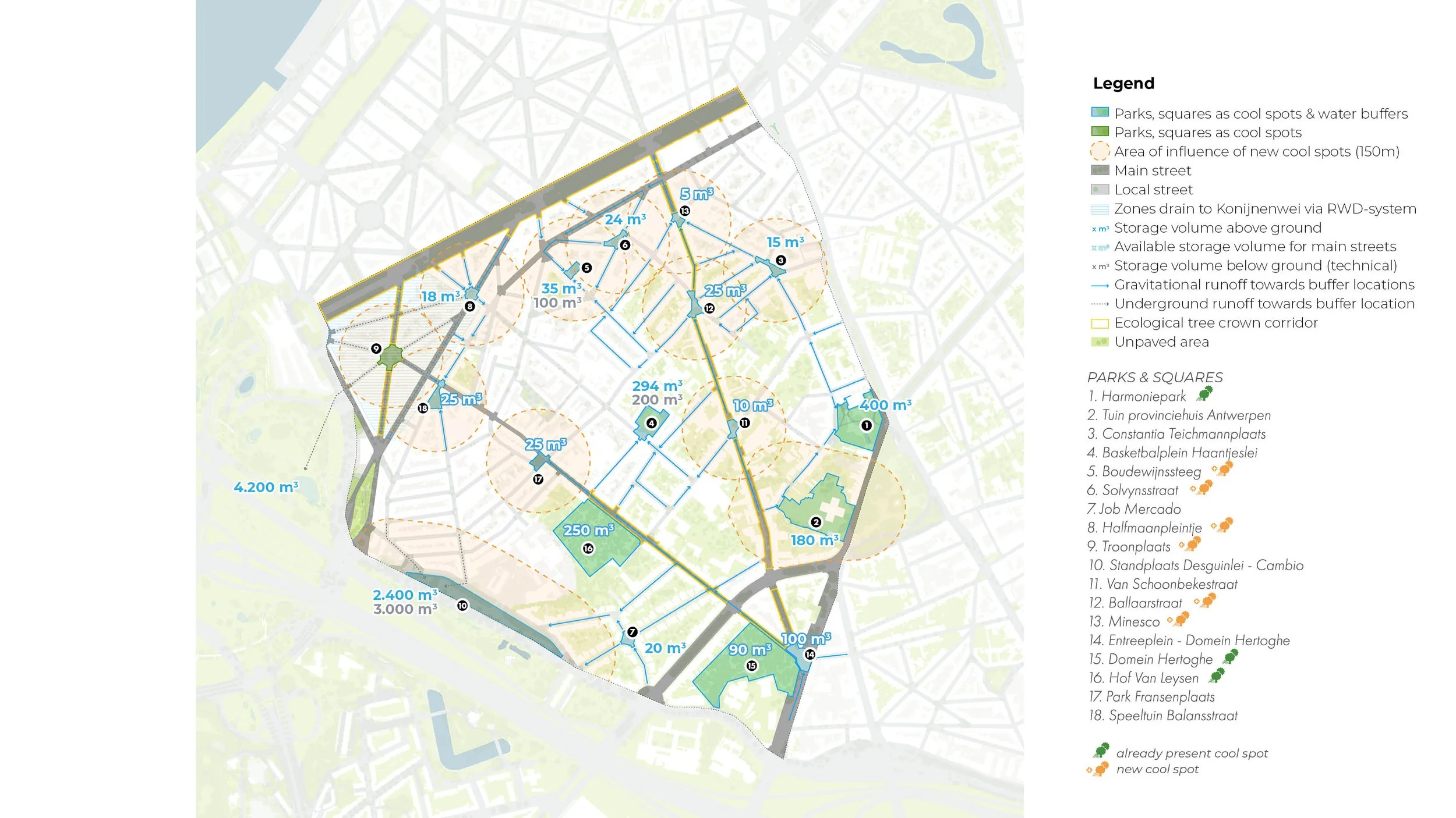
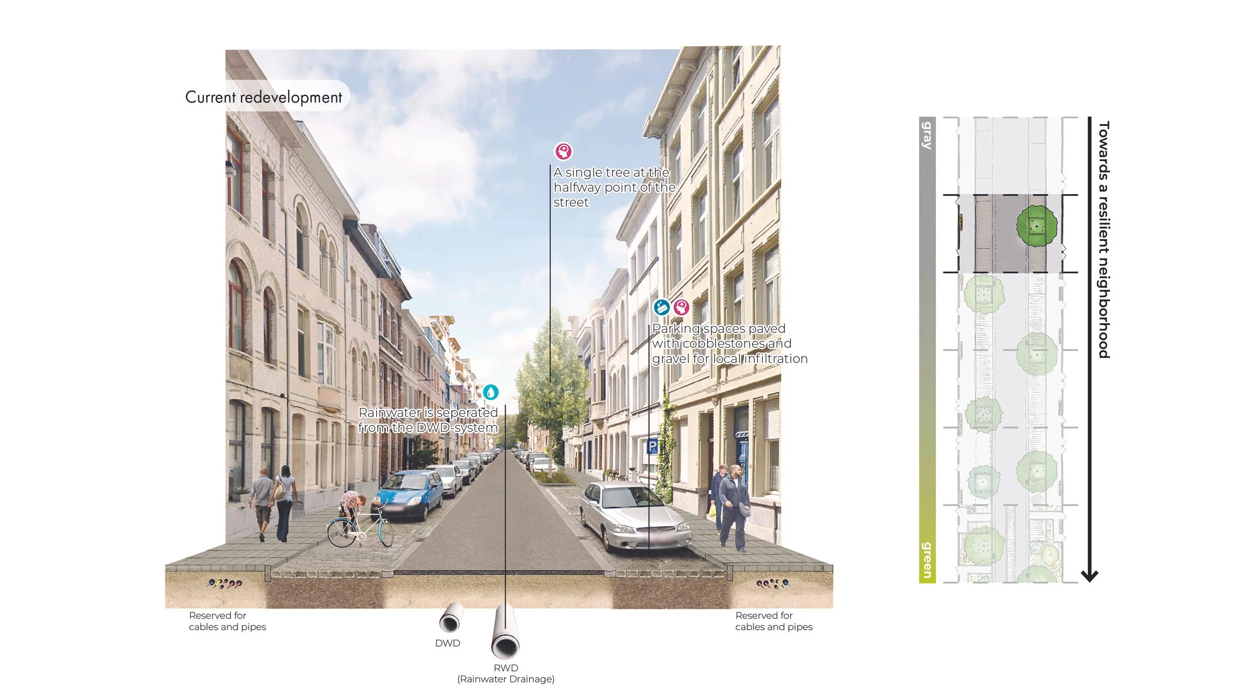
Using neighborhood scans, the issues on water, drought, heat and biodiversity are mapped and solutions can be proposed. For example, the hollow morphology of Brederode and its high density of paving causes water to collect both above and below ground, overcharging the sewage system in specific zones. The solution aims to buffer rainwater at strategic points and depave in order to infiltrate locally.
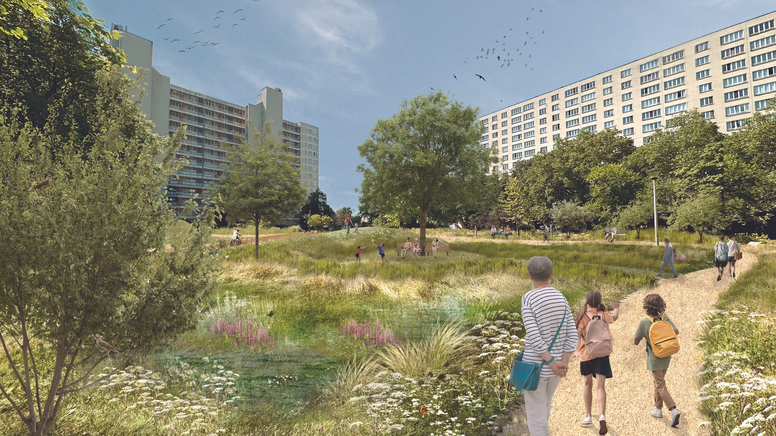
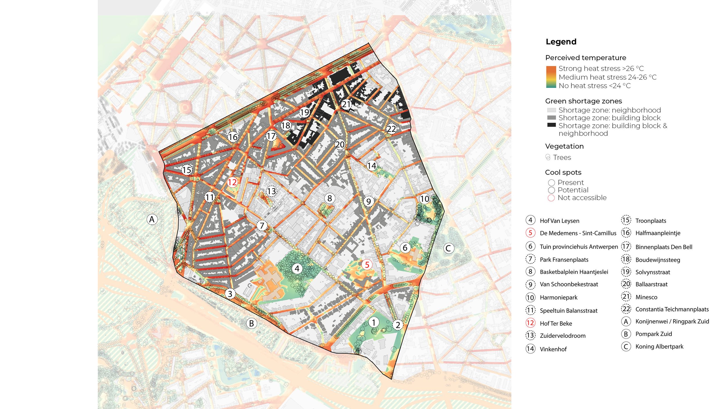
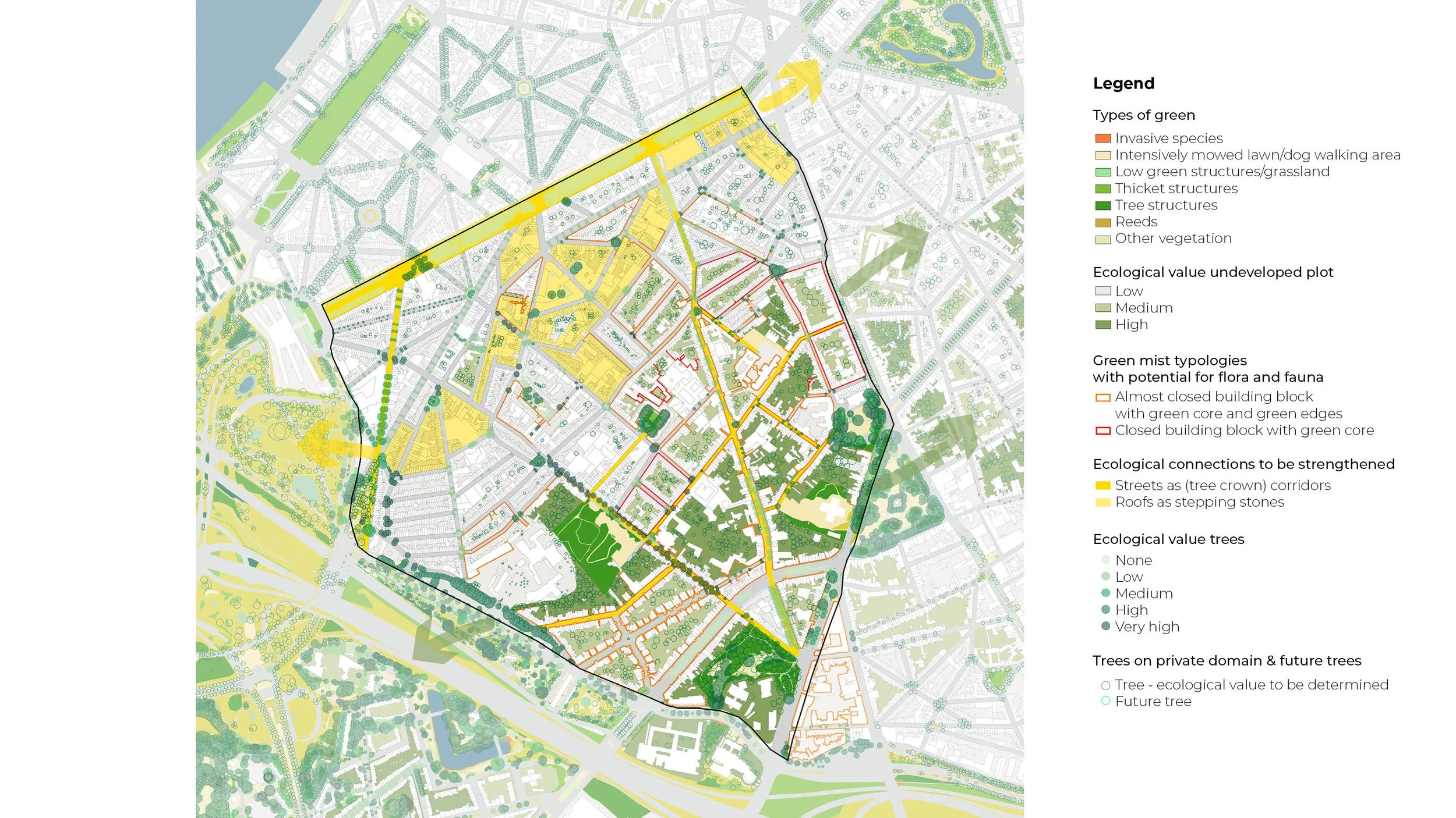
For heat and biodiversity, the district currently has cool and ecologically valuable areas, but they are unevenly distributed and lack interconnections. Based on these insights, the intermediate streets, crossings, squares and green zones are appointed as routes and stepping stones to create a cool and ecological network.
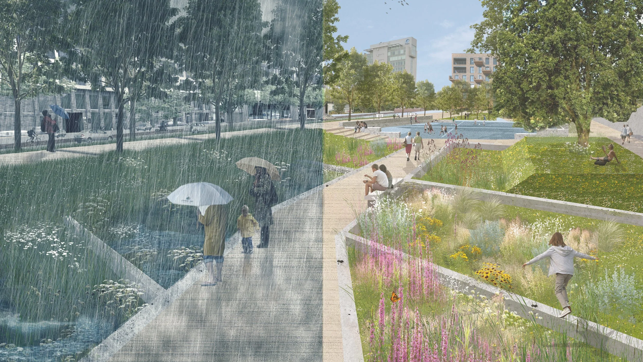
Solving these four issues not only allows the districts to adapt to a changing future, it ensures a more attractive living environment as well. Measures that aim to create green, cooling spaces mitigate the effects of climate change. At the same time, strengthening the blue-green systems creates a network of pleasant routes and places to stays
Main streets, squares and parks
As main streets, squares and parks function as the backbone to the districts, measures are catered to their specific function and character. Within the mobility system, main streets offer little room for measures above ground. These streets will therefore aim to buffer water below their surface.
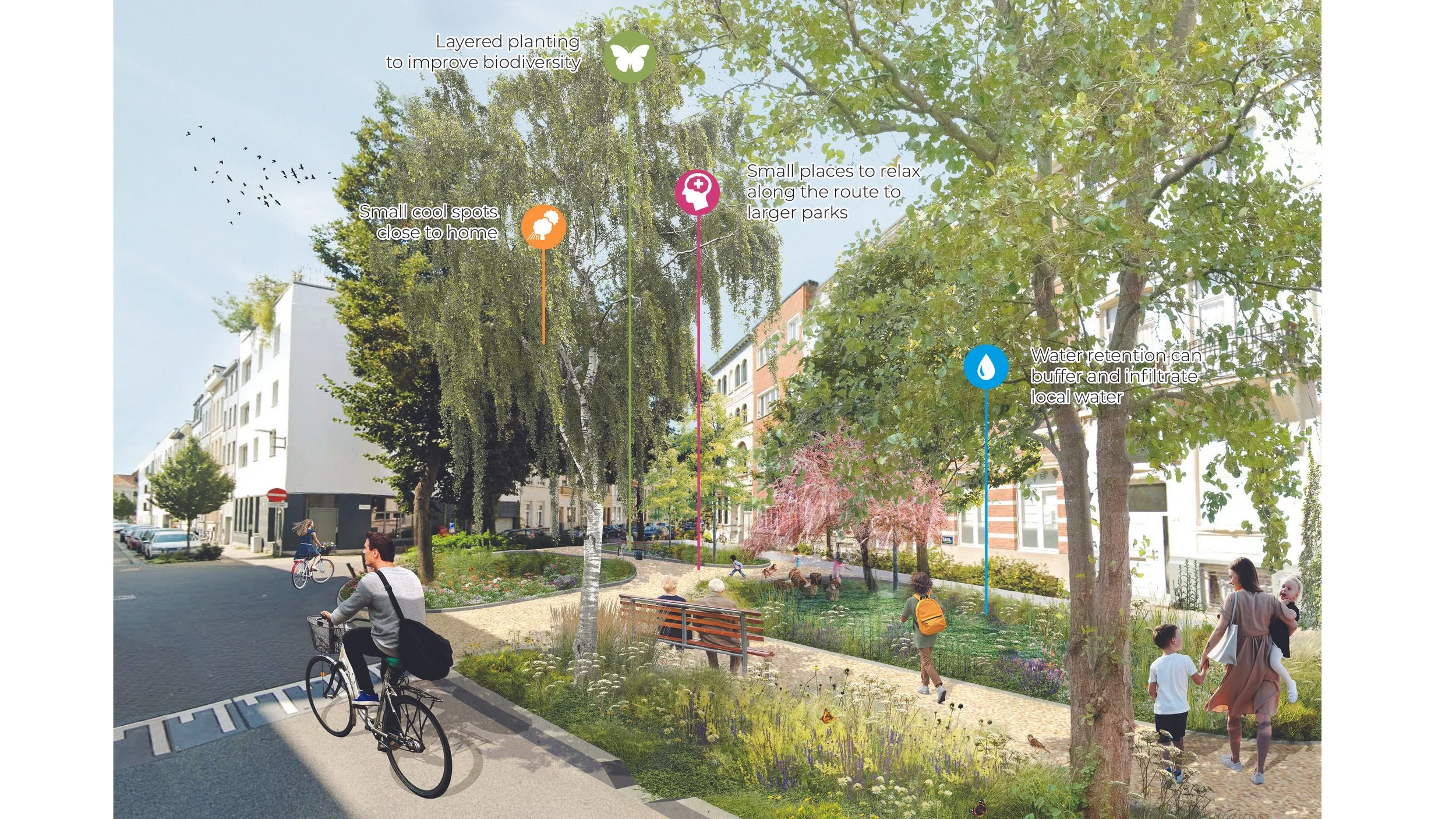
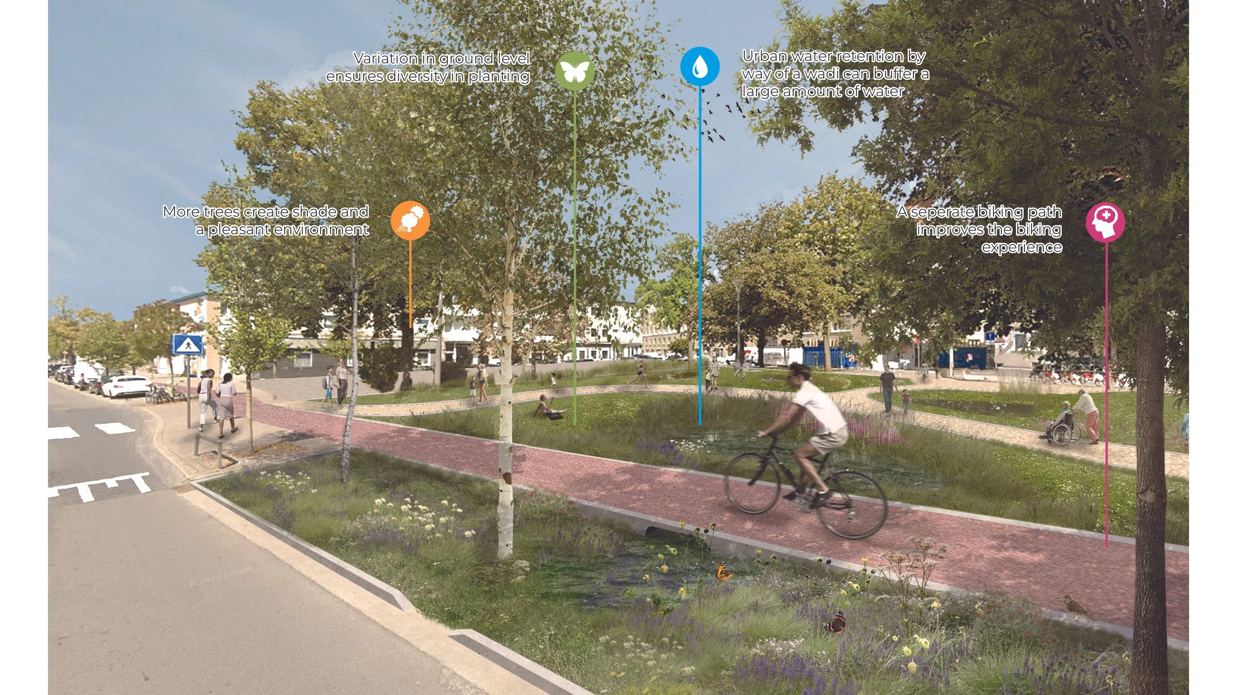
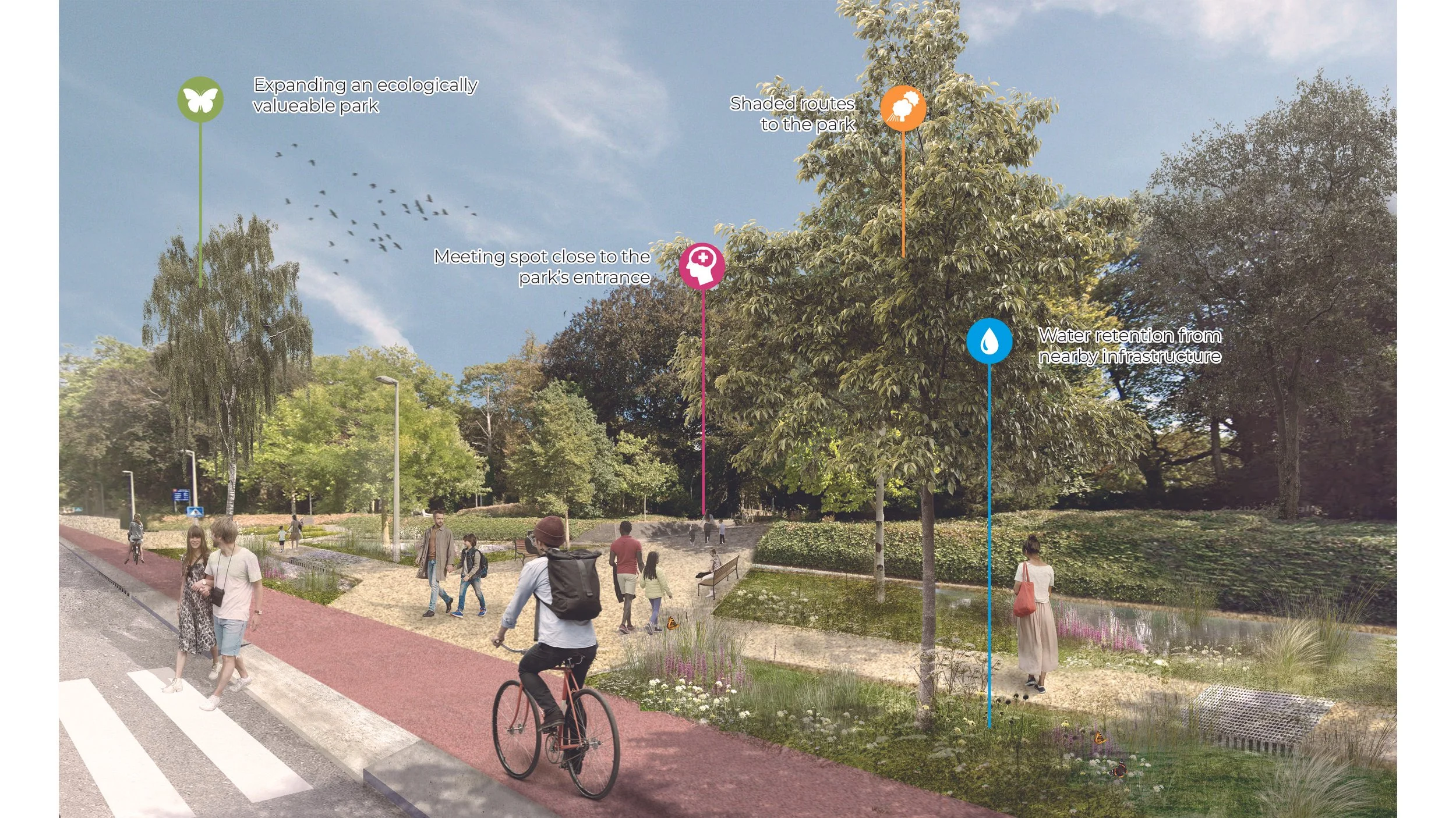
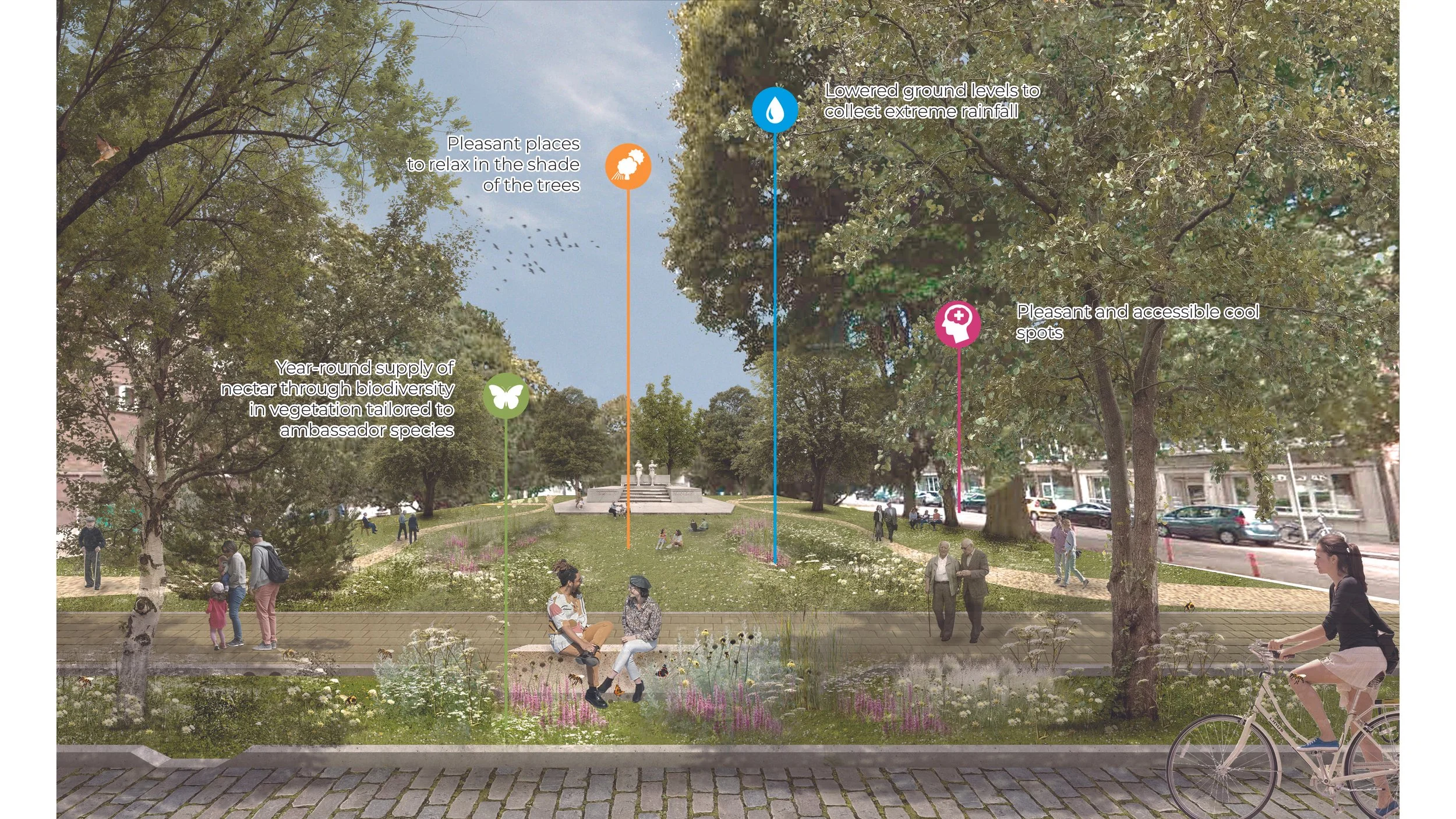
Squares and parks do offer more room and will host new or strengthened buffering locations, cool spots and ecological zones. By becoming stepping stones, they will connect to the larger green structures, such as the Ringpark along the city center.
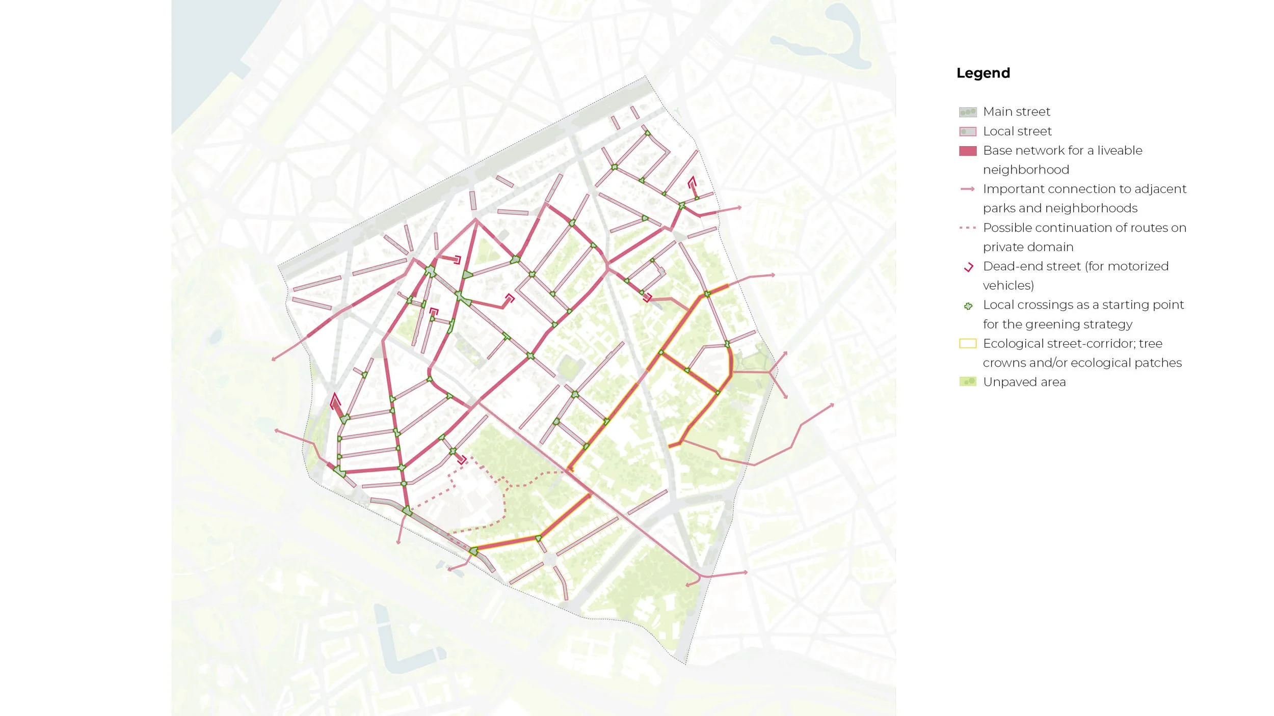
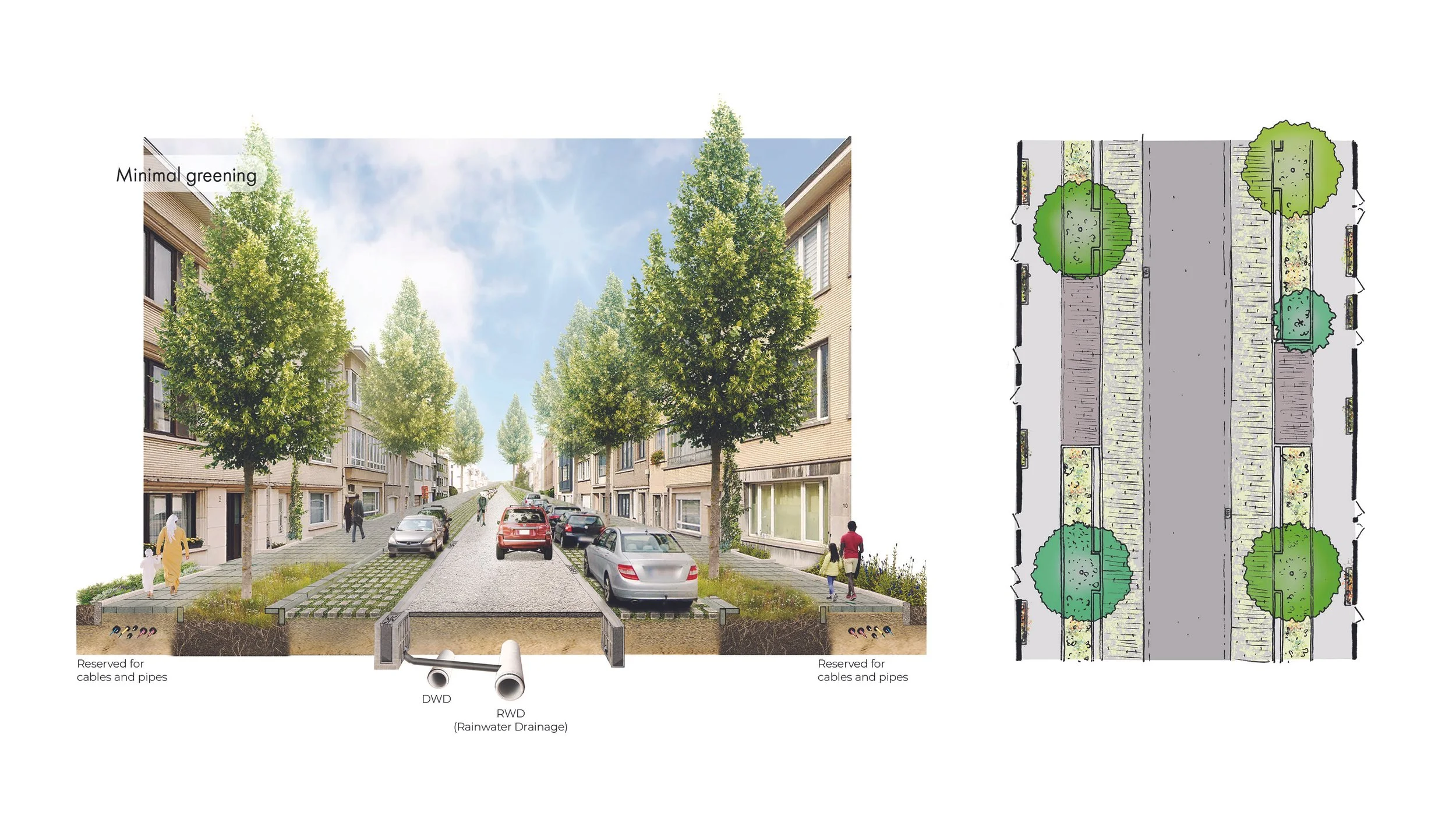
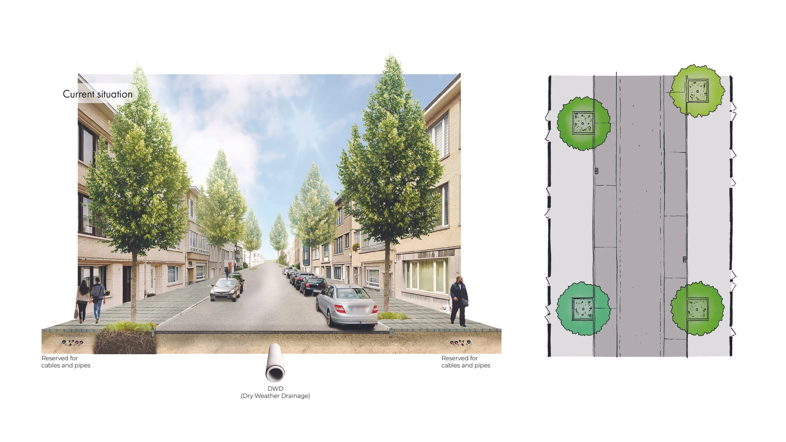
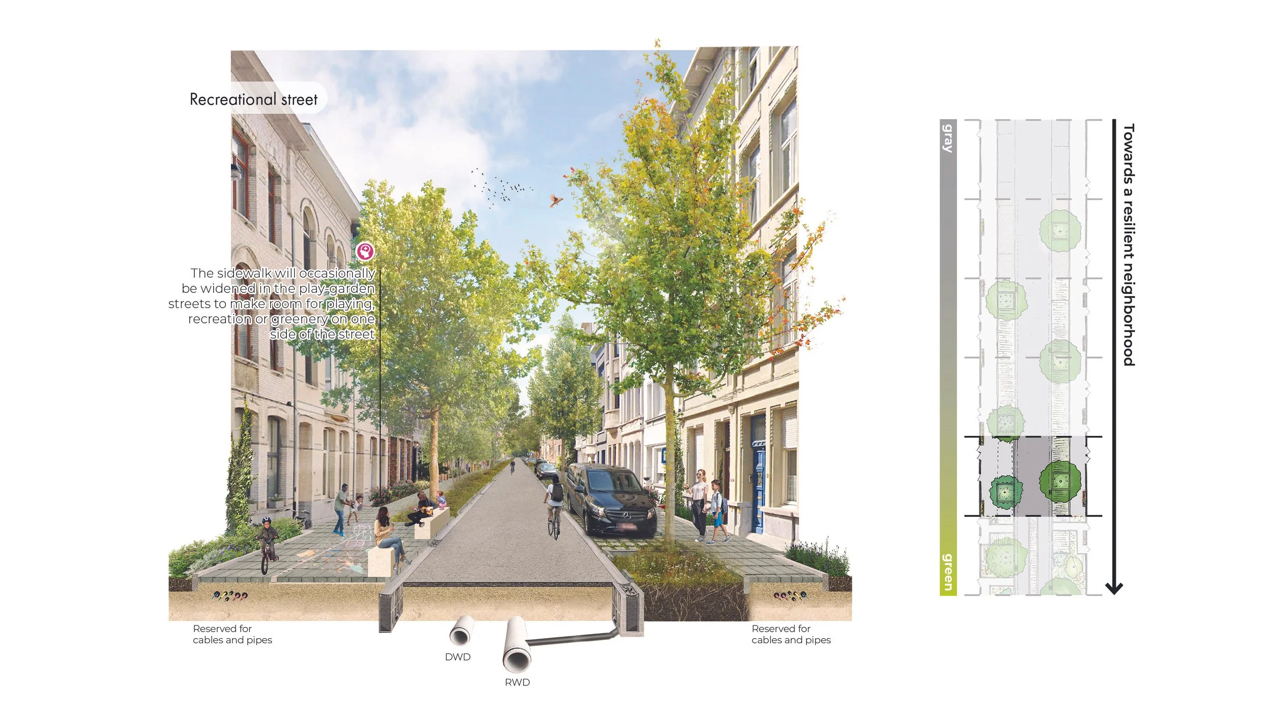
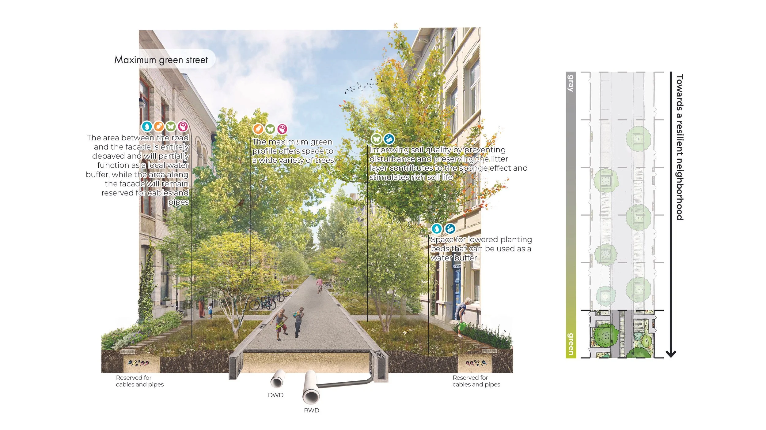
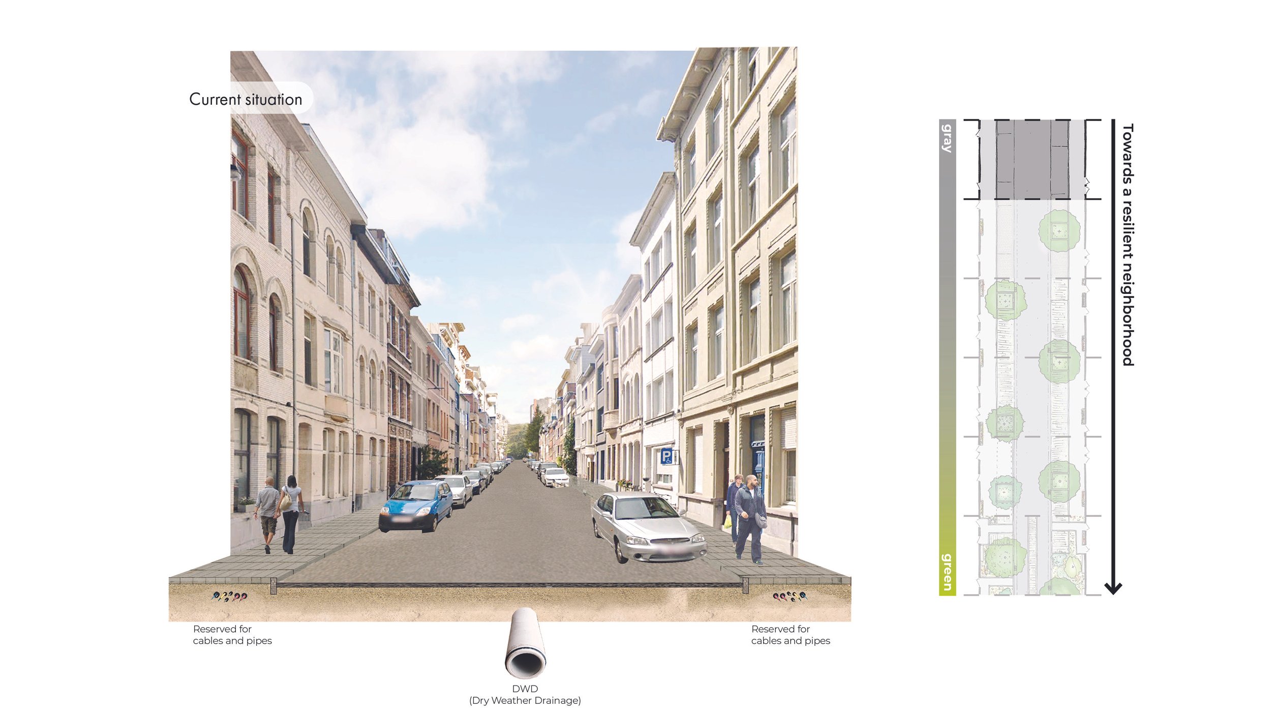
Local streets
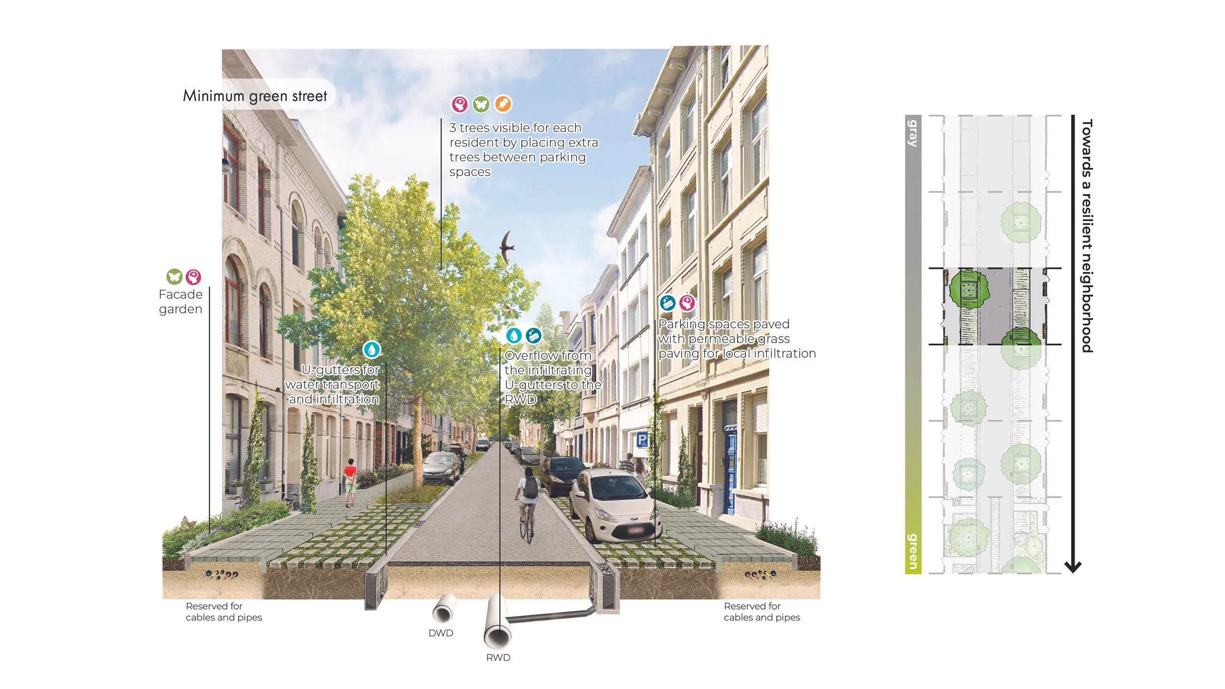
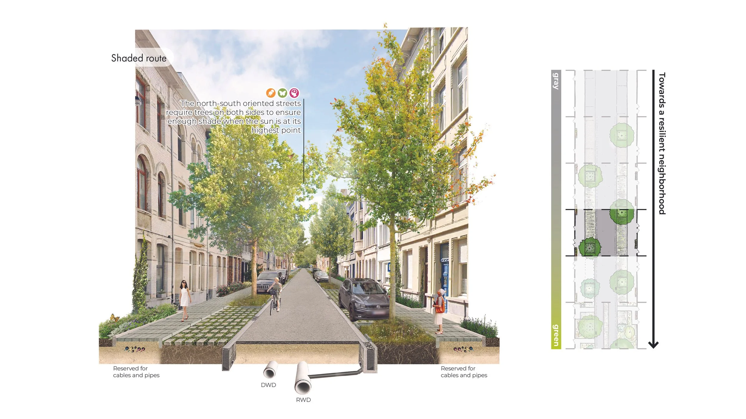
The intermediate streets and crossings can further strengthen the blue-green network by connecting the stepping stones. Measures like depaving and adding trees impacts water management, heat stress and ecological connections. Besides mitigating climate change effects, these streets have value by providing a comfortable environment for the inhabitants.
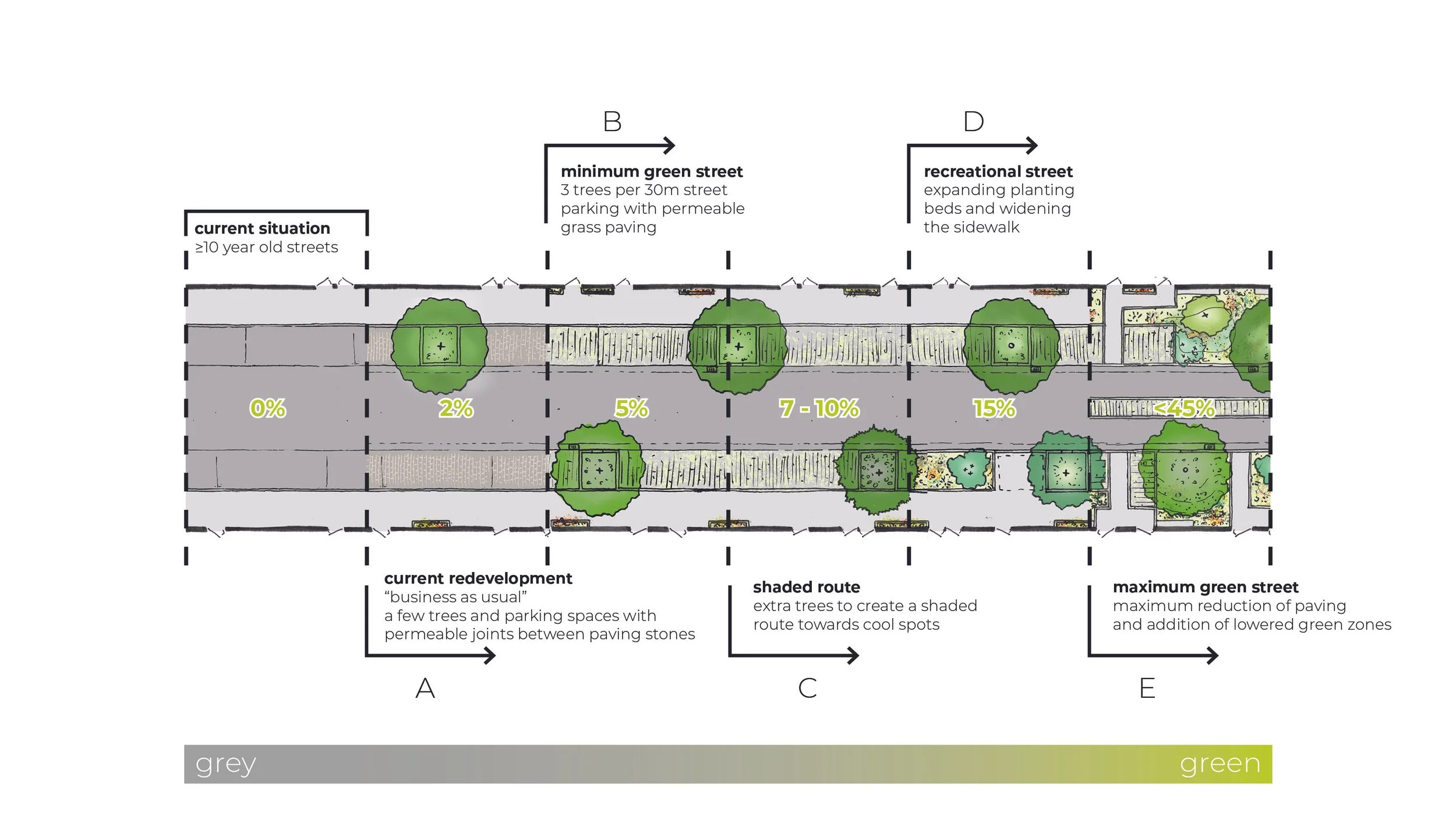
Stratgey
As the three districts currently lack a strong blue-green network, the strategy aims to restore it by combining local measures to a district-wide approach. As illustrated by the water management, local streets are transformed to either buffer rainwater locally or transport it to a nearby buffer location. This relatively small-scale measure, when applied to all streets, is what creates a neighborhood network. In this way, the project aims to prepare Antwerpen for climate adaptation. Not by a collection of unconnected measures, but a unified system where water and green strengthen the public space.