Subsidence & Heritage
Gouda, The Netherlands
Location | Gouda, The Netherlands
Year | 2022
Client | Municipality of Gouda
Status | Research by design
Collaboration | STATS Architecten
The city of Gouda is constantly dealing with soil subsidence, with visible consequences for buildings, public space and its historical center. De Urbanisten researched the effects of this phenomenon in public space and developed a decision making toolbox to help the local administration develop long-term strategies for the city.
Like in much of the lower parts of the Netherlands, the peaty soil under the city has been subsiding for centuries and will continue to do so for centuries to come. De Urbanisten were invited to conduct a research by design to visualize the long-term spatial consequences of soil subsidence in the protected historic city and investigate possible approaches to the diverse problems caused by this process: uneven streets, damage to protected buildings and public spaces, accessibility, flooding.

Soil subsidence damages and selected locations
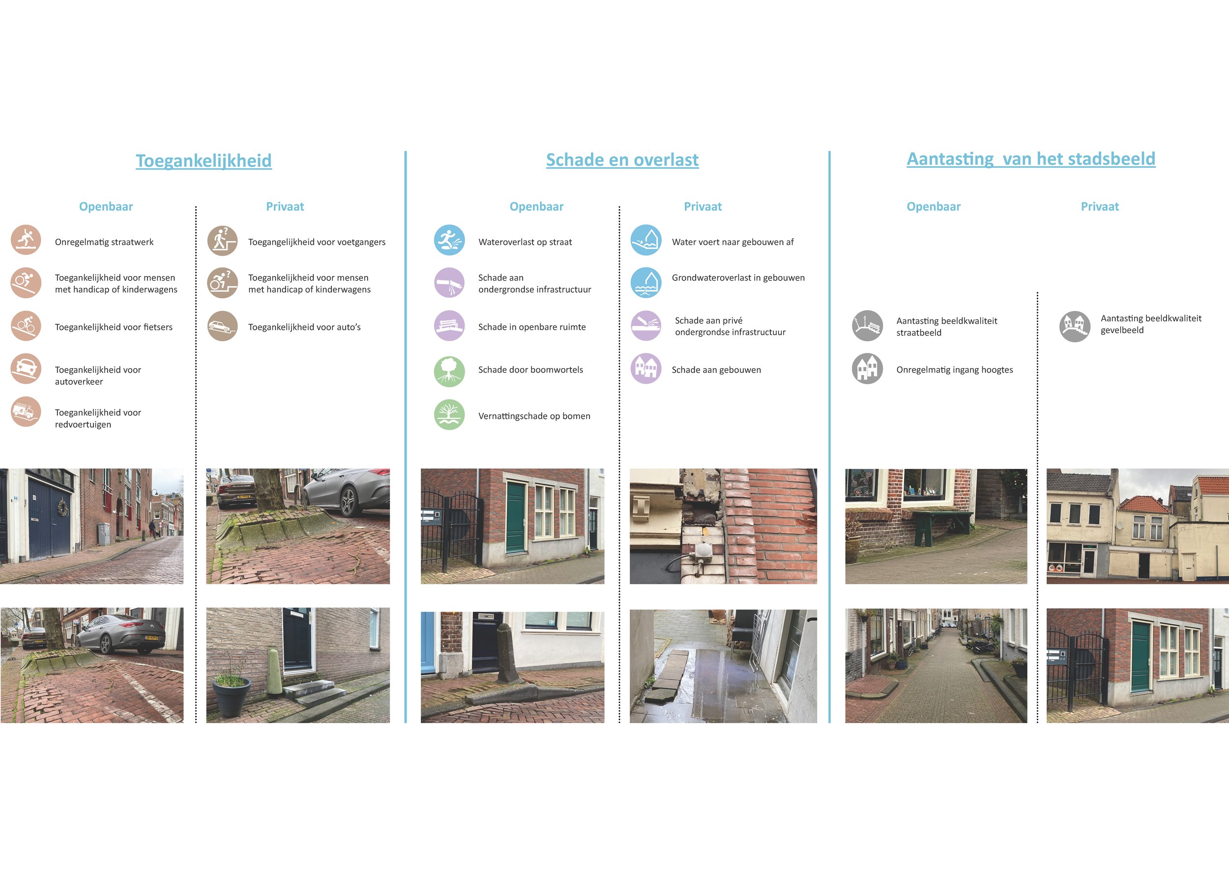
Soil subsidence damages

Datasets and portals used for modelling

Modelling the typography

Modelling the architecture

Modelling the subsidence
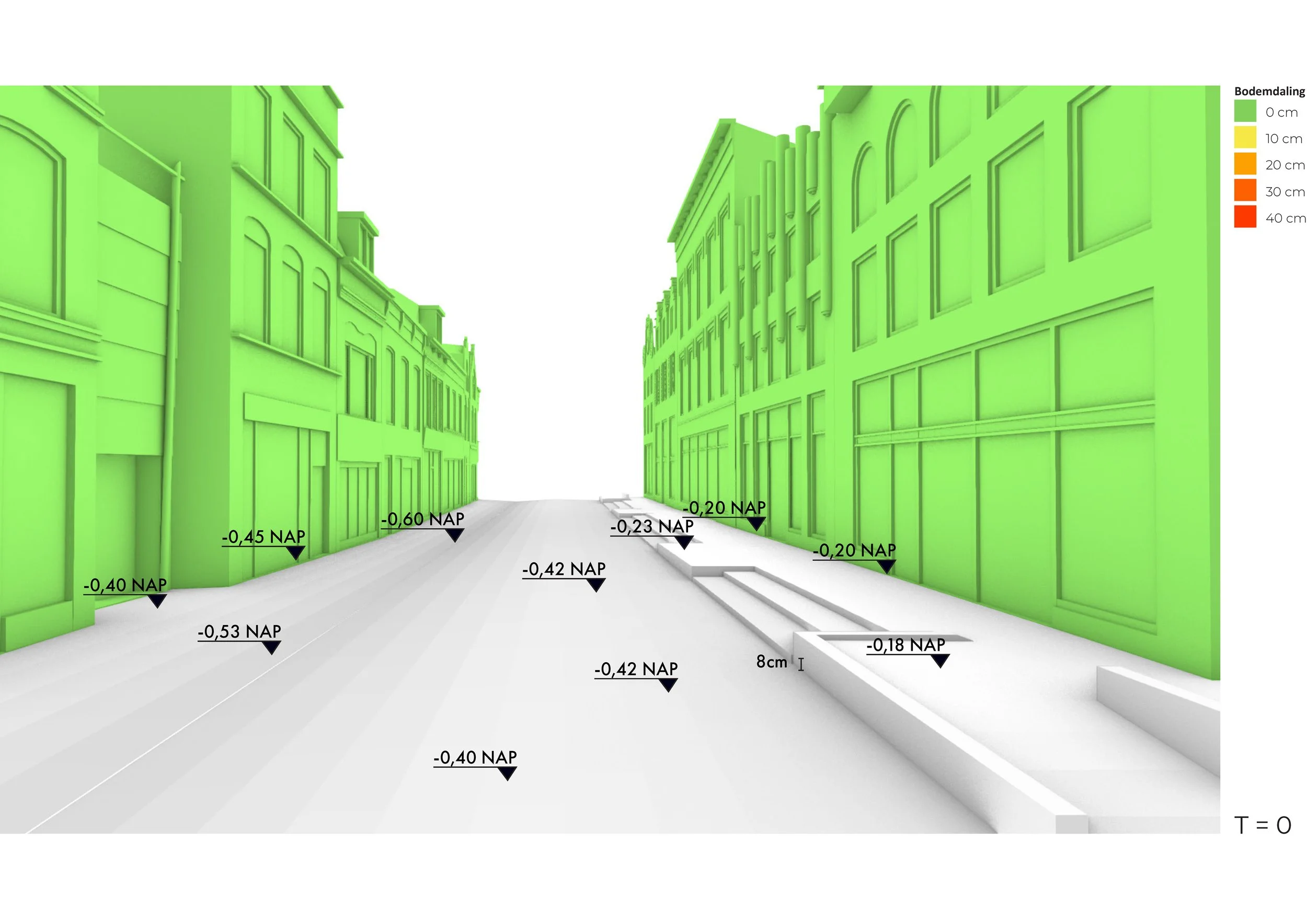
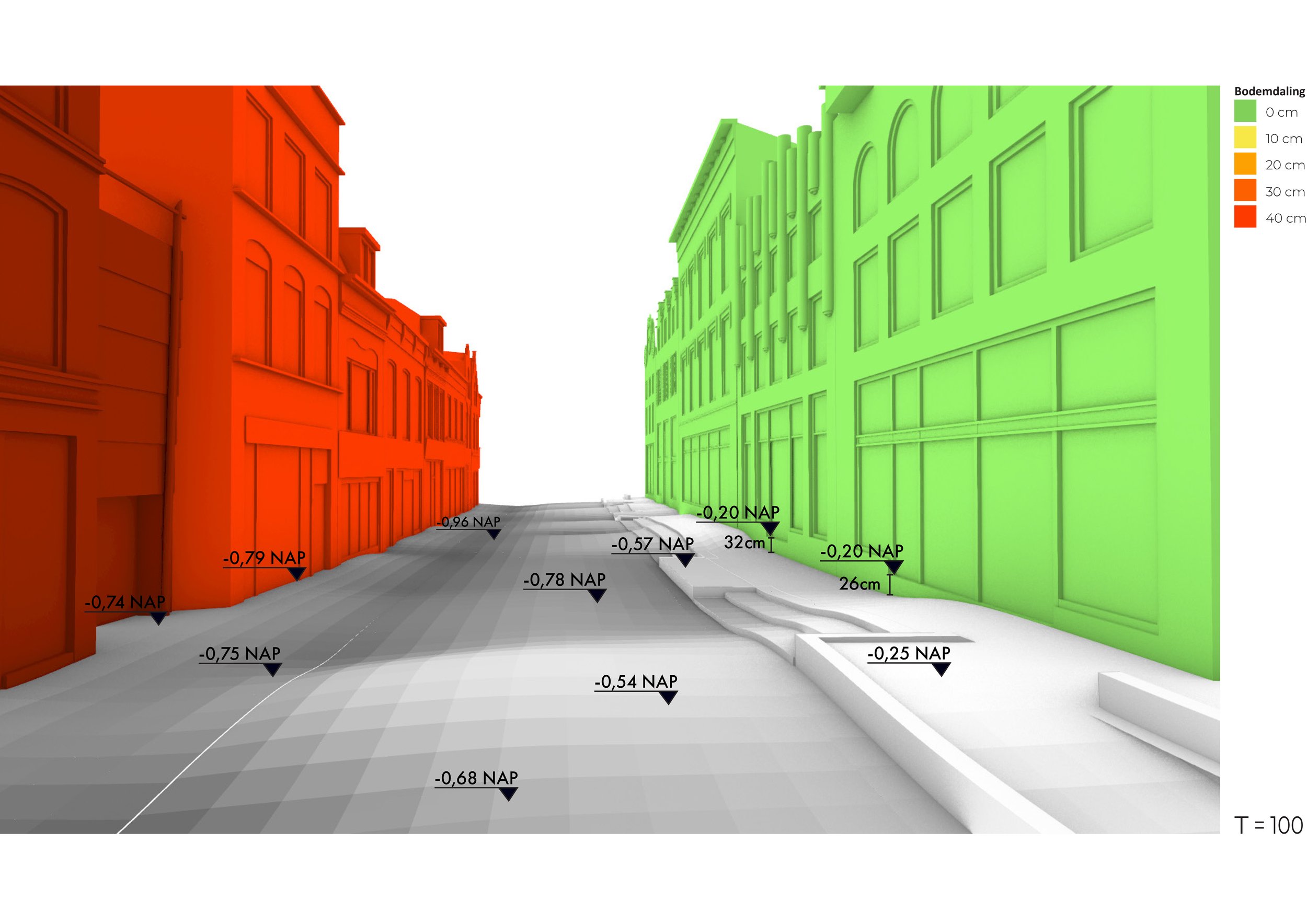
Four emblematic locations were selected and, using the available data and maps, the existing situation was modelled in 3D. Based on fine -grained data points from Skygeo, we modelled the expected subsidence over 50 and 100 years for the four sites and identified potential threats caused by subsidence in each specific site.
Kleiweg, current situation

Kleiweg, expected soil subsidence in 50 years
Kleiweg, expected soil subsidence in 100 years

Kleiweg, threats analysis

Kleiweg section, current situation

Kleiweg section, expected subsidence in 100 years
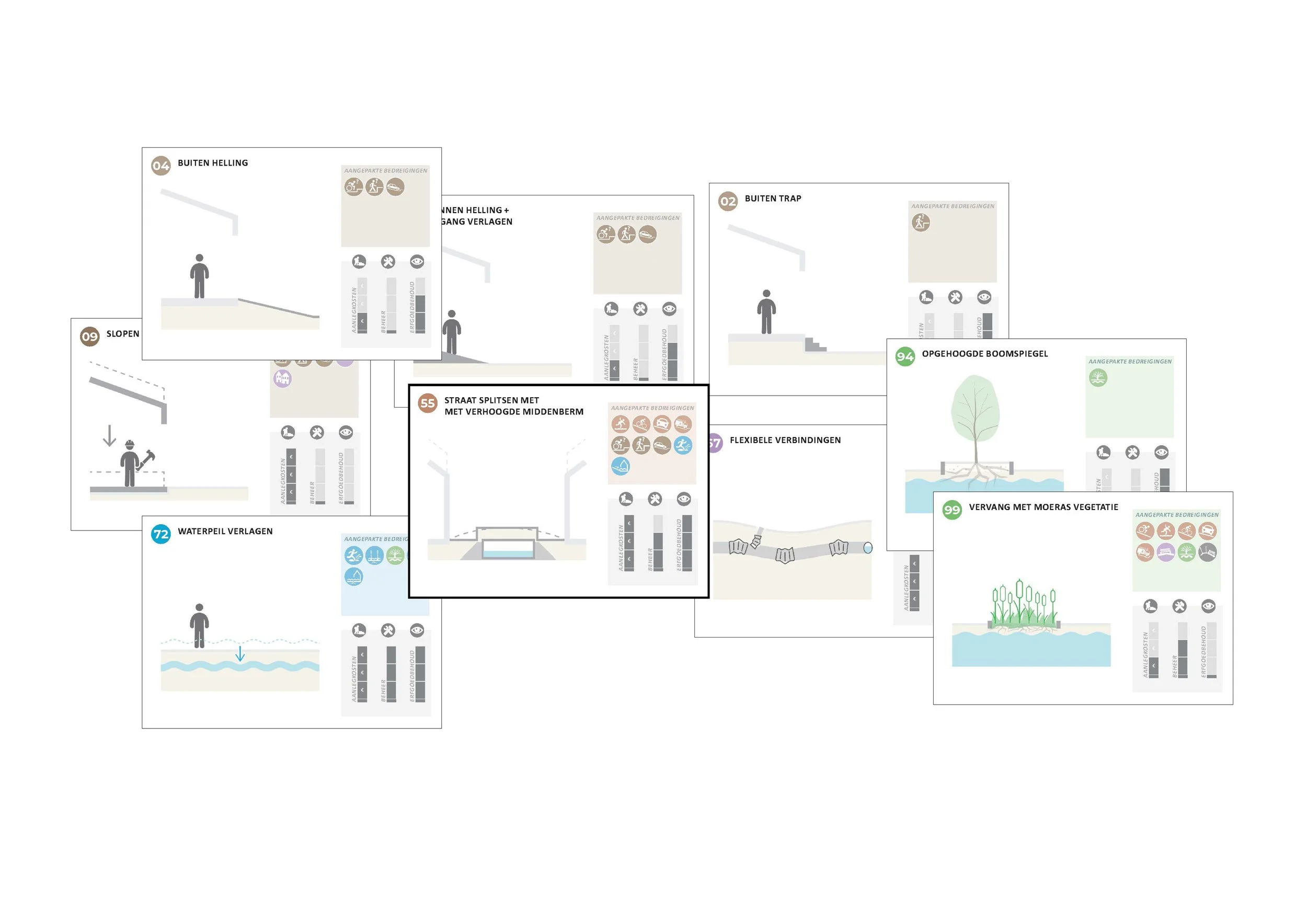
Based on this analysis, we developed a toolbox for soil subsidence which categorizes possible issues and a set of different solutions. This toolbox was used during workshops with a multidisciplinary team of the city of Gouda to generate possible strategies by selecting “clouds” of tools that were best fit to tackle soil subsidence in the specific locations and .
The toolbox became an inspiring and fun way for the municipality to discuss the complexities of subsidence and get dilemmas and choices on the table.

Toolbox, situations and categories

Workshop with city of Gouda

Strategy clouds for Kleiweg

Preferred strategy clouds for Kleiweg
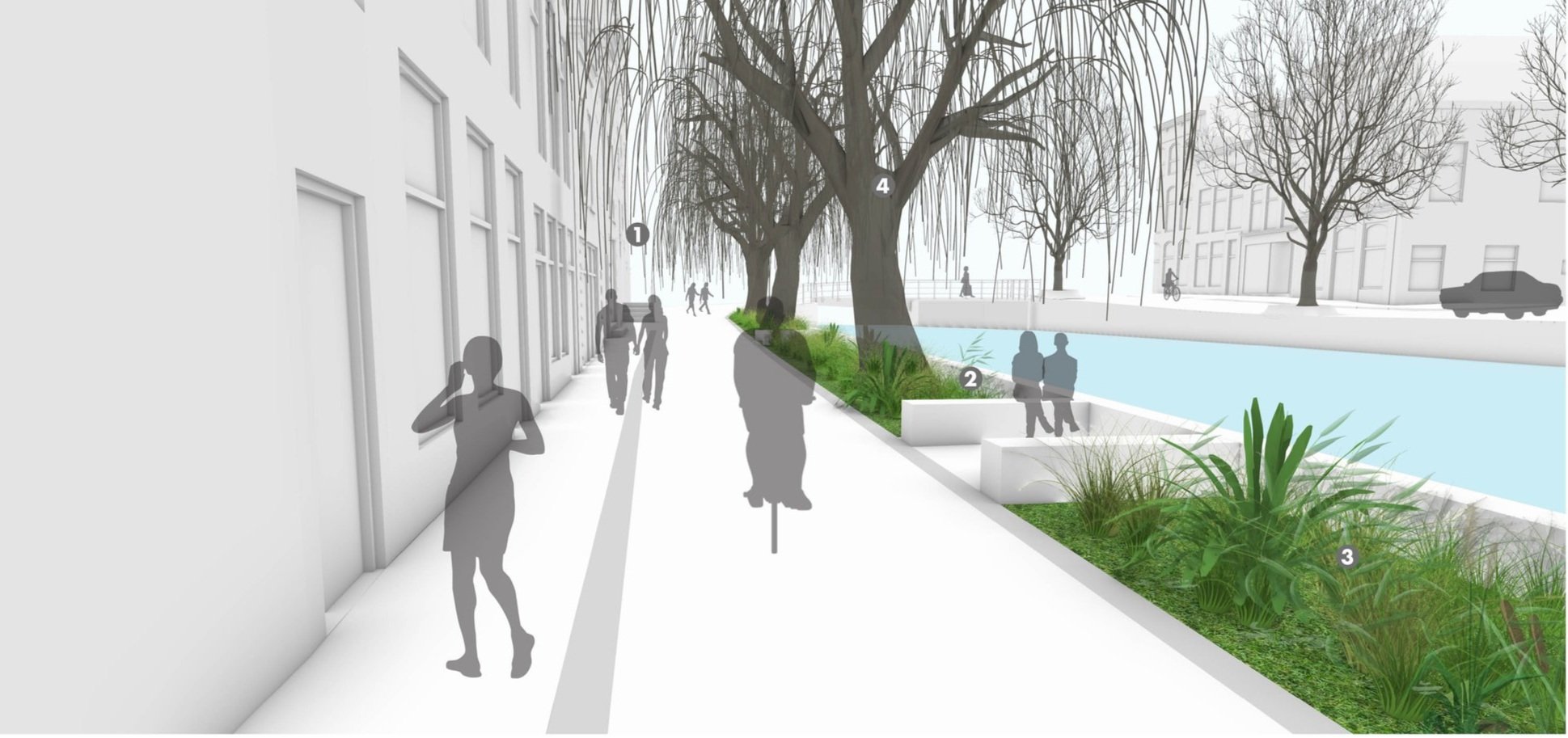
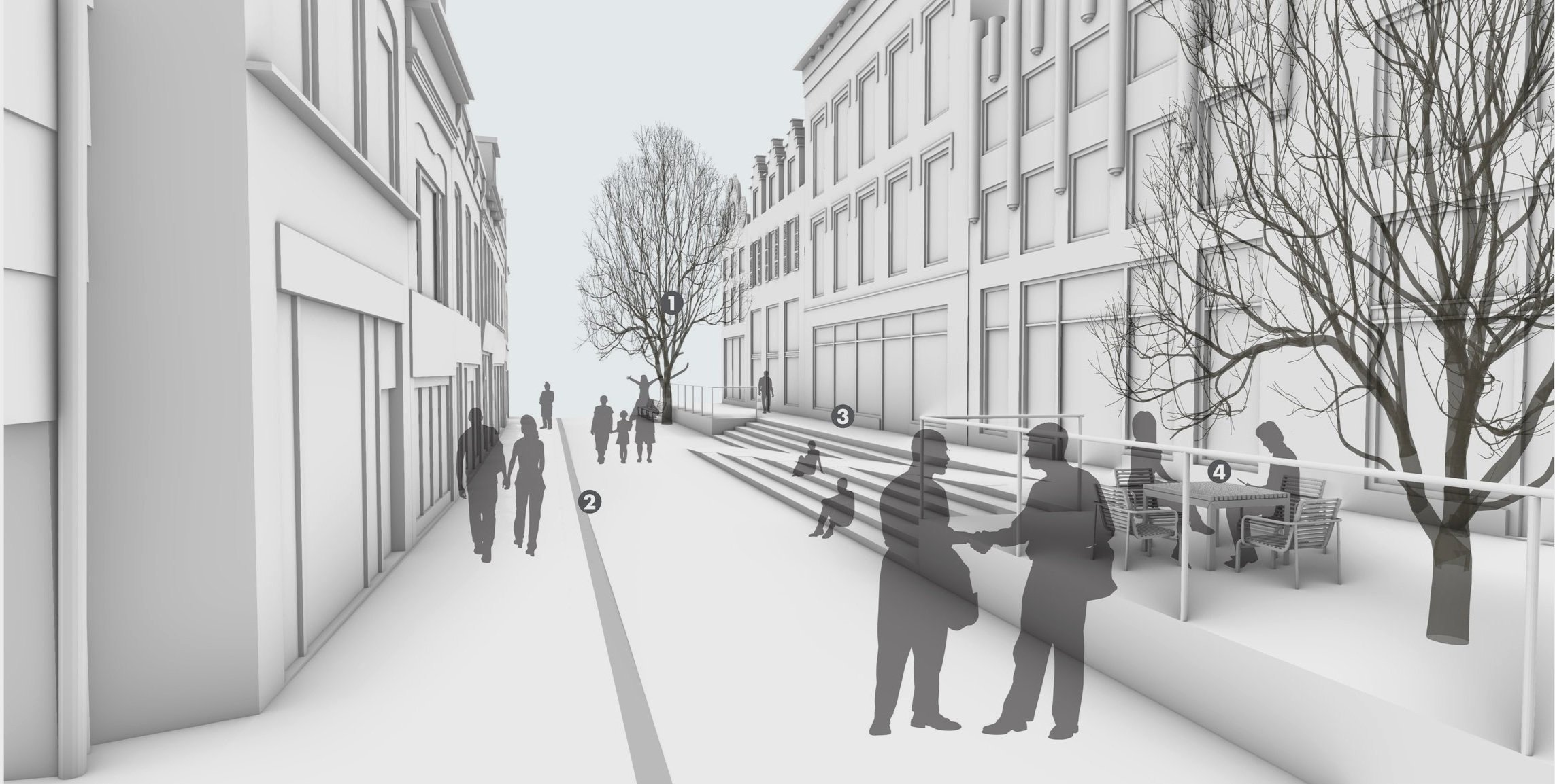
After selecting the most appealing strategy clouds with the municipality, we modelled how the implementation of such strategies would look like. This approach helps municipalities visualize the effects of soil subsidence in their cities and better grasp the effects this phenomenon has on the quality of the public realm. These images help to draw administrative attention to the problem and to make choices on future long-term strategies.

Kleiweg, subsidence and threats analysis

Kleiweg, tools cloud

Kleiweg, design solution based on cloud

Vrouwensteeg, subsidence and threats analysis

Vrouwensteeg, tools cloud
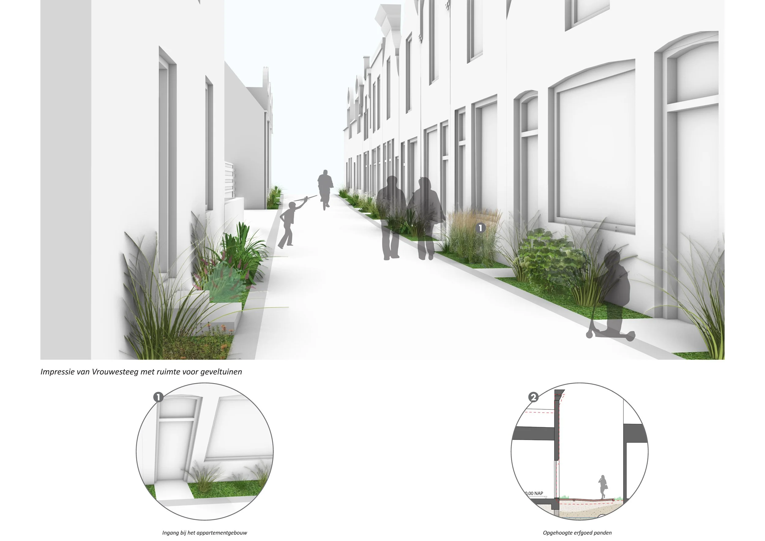
Vrouwensteeg, design solution based on cloud

Hoge & Lage Gouwe, subsidence and threats analysis

Hoge & Lage Gouwe, tools cloud

Hoge & Lage Gouwe, design solution based on cloud

Raam, subsidence and threats analysis
Raam, tools cloud
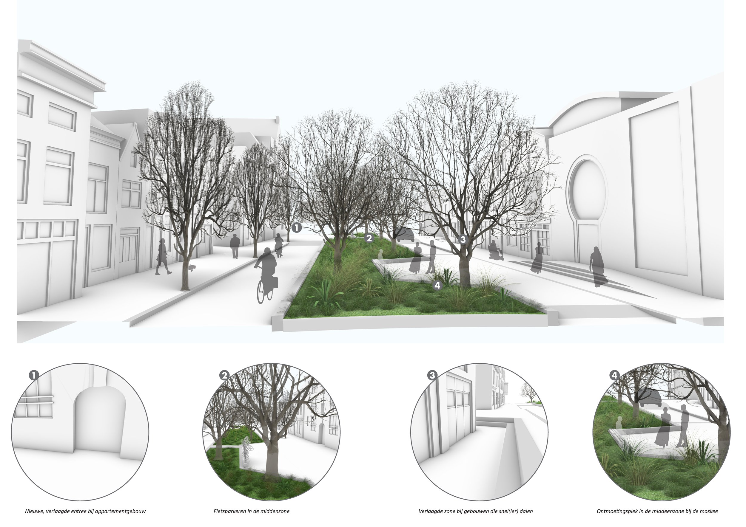
Raam, design solution based on tools cloud