
Variantestudie Noordereiland
Rotterdam, Netherlands
Noordereiland is one of Rotterdam’s most flood-prone areas. the Delta Works have improved safety, new climate models and rising sea levels indicate that the risk continues to grow. Commissioned by the Municipality of Rotterdam, De Urbanisten explored long-term strategies, from raising quays to allowing controlled flooding, while identifying opportunities to enhance the spatial quality and safety of the island.
Possible futures
Sea level is rising and climate models are showing what are the different scenarios we will have to prepare for. To assess flooding scenarios for Noordereiland, we used the study “Nadere overstromingsrisico-analyse Noordereiland” by the Municipality of Rotterdam’s Engineering Department. An average of the expected sea level rises as shown in KNMI 2023 is used in combination with climate models from KNMI 2014.
Four key high water scenarios water levels were chosen and it was calculated how likely they are to occur in different moments in time. This showed how water levels that are today extreme and very unlikely to happen, could become increasingly more frequent in the years to come.
For example, referring to the table in the images, +3,20mNAP has a chance of happening once in 300 years with today’s climate, once in 50 years with the climate of 2050, and once in ten years with the climate of 2100.

Flooding scenarios along the Maas
+2.90m NAP
The expected water level is lower than +3.00m NAP, so the Maeslantkering remains open. Some low quays are flooded, especially in the older central parts of the city, where the quays have not been raised. Precautionary measures are taken. There is a small risk of water entering homes.
+3.20m NAP
The expected water level is lower than +3.00m NAP, so the Maeslantkering initially remains open but the storm intensifies at the last minute and the local water level may still rise due to backwater, waves, and strong winds. The chance of this happening is very small. Areas outside the dykes, such as Waalhaven and M4H, parts of Loydkwartier, Kop van Zuid, Feijenoord, and Noordereiland, may be flooded.
+3.40m NAP
The expected water level is higher than +3.00m NAP, so the Maeslantkering would close, but due to a malfunction it remains open. The flooded areas are the same as in the previous scenario, but with greater damage.
+3.90m NAP
The expected water level is much higher than +3.00m NAP, so the Maeslantkering would close, but due to a malfunction it remains open. All of the areas outside the dikes will flood except Botlek, Maasvlaakte and Europort. This scenario is extremely unlikely to happen and only to be considered with the climate of 2100.

+2.90m NAP

+3.20m NAP

+3.40m NAP
+3.90m NAP
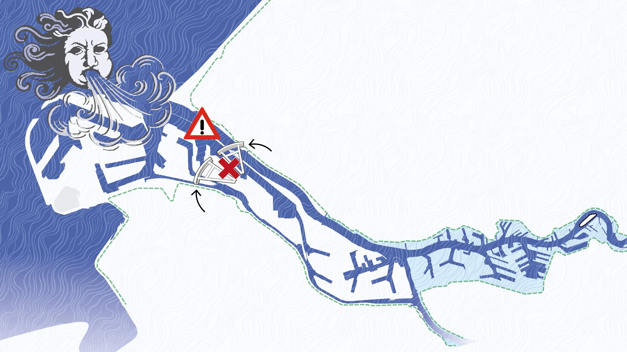
Noordereiland and the river
Visiting the Noordereiland to thoroughly categorize all of its flooding-related vulnerabilities and spatial qualities was the next step. The river plays a major role in the identity of the area, and due to the limited space there is a large amount of uses and infrastructural elements landing on the quays. Two scales have been explored: the Noordereiland as a whole, and that of the individual building.

+2.90m NAP

+2.90m NAP

+2.90m NAP

+3.20m NAP

+3.20m NAP

+3.20m NAP

+3.40m NAP
+3.40m NAP

+3.40m NAP

+3.90m NAP

+3.90m NAP

+3.90m NAP
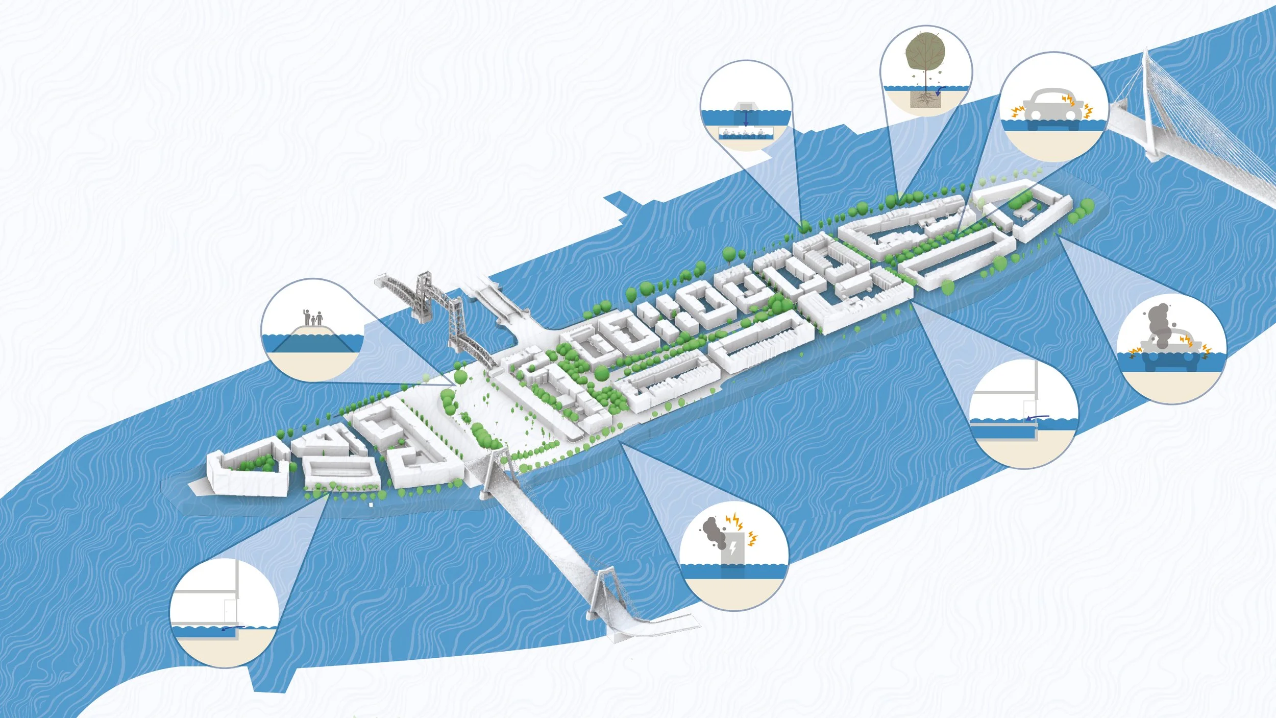
Measures
Once identified the issues, we moved onto defining a set of measures based on the theory of multi-layered safety, where the first level is prevention, the second focuses on improving and preparing the area with sustainable spatial solutions, and the third organizes and coordinates a secure, solid management of crisis and extreme events.


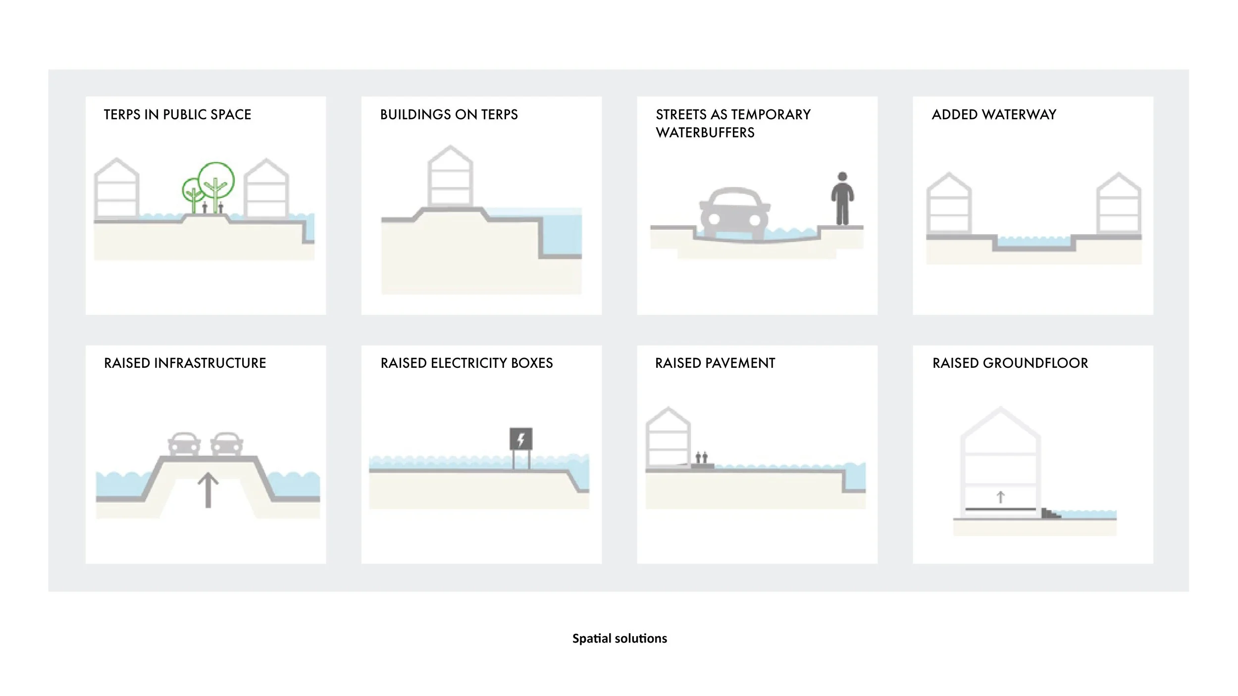
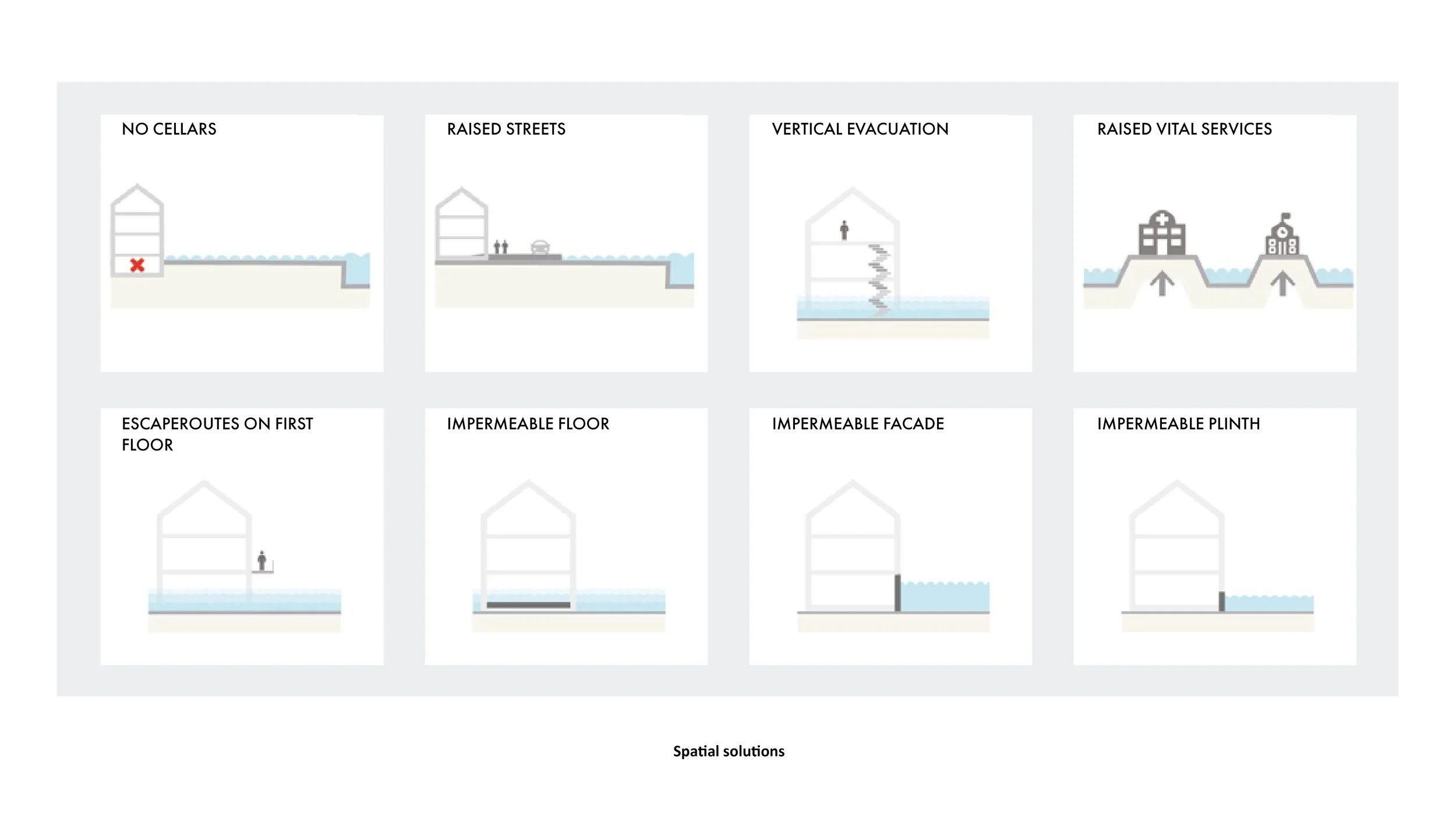

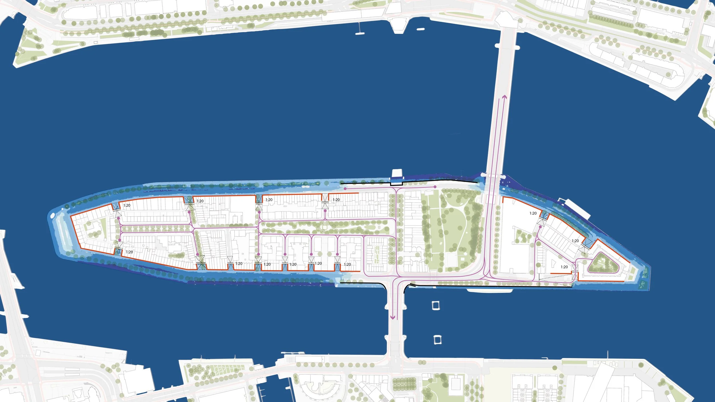
Variants
Once the measures and the different layers of safety were defined, we elaborated on how to translate them in the built environment. This led to three variants: a usable, diverse retaining wall, an enjoyable, ecologically valuable small dike, both measures aimed at keeping the flooding limited to the outer quay, or a renovation of the buildings along the waterfront to allow a controlled flooding of the streets, preventing damages.


Diverse reatining wall Protecting the Noorderailand by adding a linear barrier all along its perimeter proved to be an effective idea, but several considerations are taken into account: the little wall is acceptable because it is low enough to maintain a direct visual relationship with the river, it needs to have crossing points accessible for wheelchairs, to be positioned in a way that does not interfere with the root system of the existing trees and protecting the ground level planting at the same time. With this in mind, we thought of different ways to activate it to be more than just a simple wall and more of a connecting element.


Dike Another approach is wrapping a small dike all around the island. To strengthen the relationship with the Maas, we chose a maximum slope of 1:6 on the outer side of the dike. This is a comfortable ratio for people to actually use the dike, turning it into a place rather than just a barrier. In order not to cut down the existing trees, the slope only becomes steeper where they are planted. The impact this approach has on the current street profile is that parking lots along the water side need to be taken out.
Renovation of the buildings Another viable option is to allow the quays of the Noordereiland to flood, blocking the water from entering the heart of the island by water-proofing the facades and adding soft, wheelchair accessible slopes in the crossings. While this approach has the least impact in terms of renovation of the public space, it requires good cooperation among the inhabitants and monitoring to ensure that, for example, all the cars can be moved out of the quays when high water is expected.
