Flood Proof Noordereiland
Rotterdam, Netherlands
Due to its location in the outer dike area of Rotterdam, Noordereiland is vulnerable to flooding. With rising sea levels and higher river discharges, the risk of flooding will increase in the future. Commissioned by the municipality of Rotterdam, De Urbanisten mapped out possible flood protection strategies, ranging from raising quays to allowing controlled flooding.

Unembanked Noordereiland
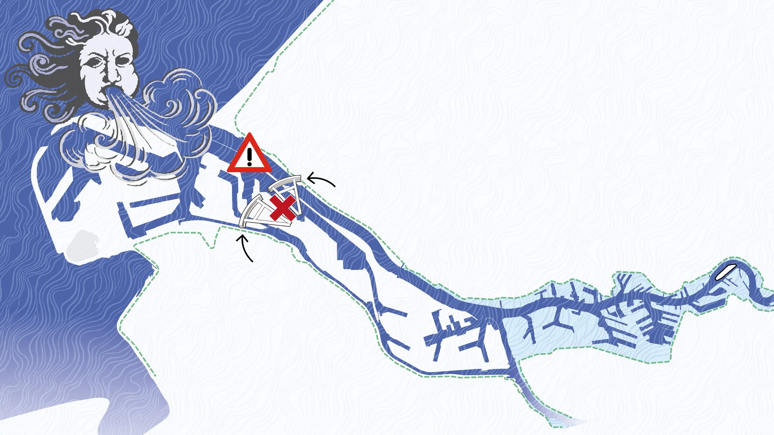
Noordereiland is an unembanked island in Rotterdam and is therefore not protected by primary flood defences. Although the Maeslant Barrier closes at water levels above NAP +3.00 metres, Maas water already occasionally inundates the quays. With ongoing sea level rise, both the probability and the spatial impact of flooding on the island will increase significantly. This study explores the long-term implications of high-water scenarios for Noordereiland and translates these into spatial opportunities.
Each scenario is linked to a calculated probability of occurrence. Water levels that are currently considered extreme will become increasingly frequent. For example, a water level of NAP +3.20 metres, which today occurs once every 300 years, is expected to occur once every 50 years by 2050 and once every 10 years by 2100.
Flooding Scenarios Along the Maas River

NAP +2.90 m | Water levels remain below the closing threshold of the Maeslant Barrier. Several low-lying quays are flooded, requiring precautionary measures. Buildings largely remain dry, though incidental ingress of water cannot be excluded

NAP +3.20 m | Although the expected water level remains below NAP +3.00 metres, local effects such as wind setup, wave action and storm conditions may cause additional water level rise. In this scenario, unembanked areas including M4H, the Lloyd District, Kop van Zuid, Feijenoord and Noordereiland are susceptible to flooding.

NAP +3.40 m | Water levels exceed the closing threshold of the Maeslant Barrier. In the event of a malfunction, flooding occurs in the same areas as in the previous scenario, but with substantially increased water depths and damage potential.
NAP +3.90 m | An extreme and highly unlikely scenario, considered only within the 2100 climate outlook. In the event of barrier failure, nearly all unembanked areas are flooded, with the exception of Botlek, Maasvlakte and Europoort. Evacuation becomes unavoidable.
High-Water Scenarios and Impacts
For all four high-water scenarios, detailed flood maps have been produced. In addition, vulnerabilities and the spatial impacts of flooding have been analysed.
o NAP +2.90 m: Water accumulates on the lower quays; buildings remain safe or can be protected with relatively simple measures
o NAP +3.20 m: Almost all quays are flooded; water enters buildings located directly along the waterfront.
o NAP +3.40 m: In addition to the quays, streets on the island are flooded, with water depths of up to approximately 80 cm; buildings at higher elevation levels also experience water damage.
o NAP +3.90 m: Evacuation of the island is required; water levels on the quays reach up to 1 metre, and water enters buildings across almost the entire island.

+2.90m NAP

+2.90m NAP

+2.90m NAP

Inundation at +3.20m NAP

+3.20m NAP

+3.20m NAP

+3.40m NAP

+3.40m NAP
+3.40m NAP

+3.90m NAP

+3.90m NAP

+3.90m NAP
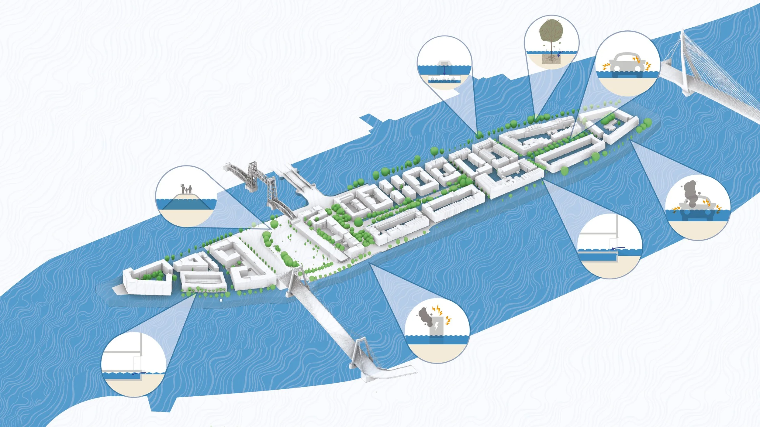
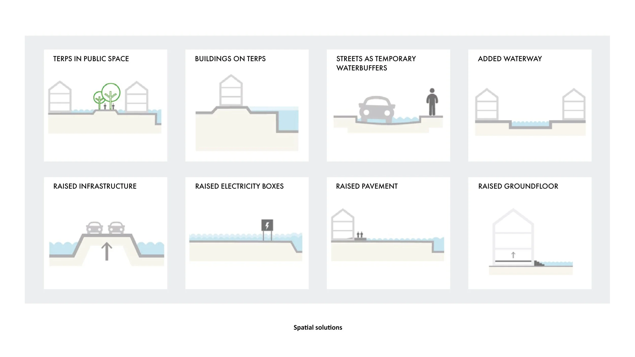
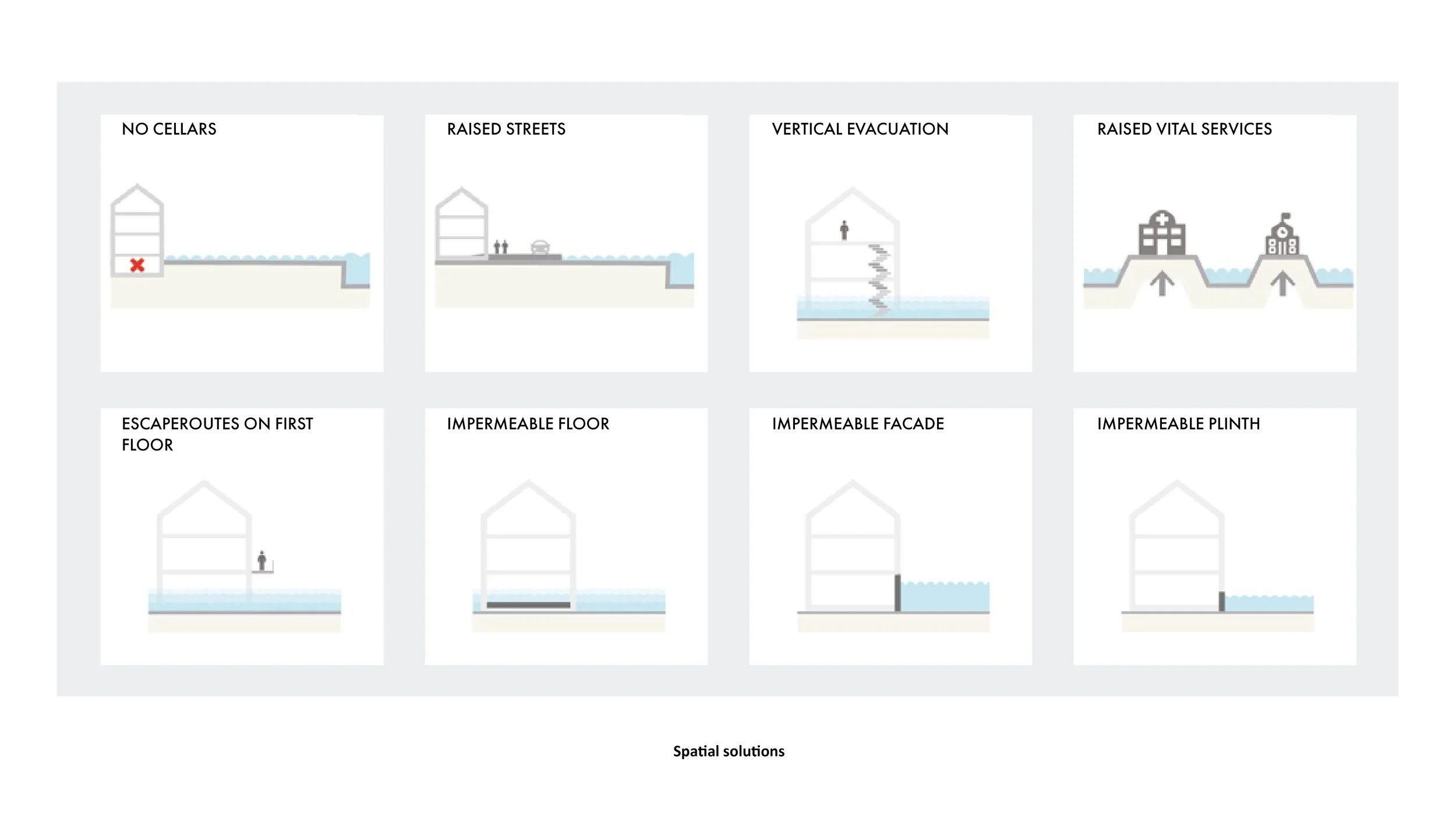
Measures
The study identifies three complementary layers of intervention:
o preventive measures (e.g. continuous or localised flood walls, dikes and demountable barriers).
o adaptive measures (e.g. raised ground levels, floodable public spaces and water-resilient architecture)
o organisational measures (e.g. clear evacuation strategies and coordinated emergency management)


Design Variants
Based on these measures, three spatial design strategies are proposed, each offering a feasible response to a water level of NAP +3.40 metres:
o a spatially integrated flood wall;
o a low, accessible dike with ecological value;
o building-based adaptation, allowing controlled flooding of public space.


Integrated Flood Wall
A continuous flood wall around the perimeter of Noordereiland offers a compact and spatially efficient solution. Due to its limited height, the wall preserves visual and physical connections with the river. Its form can be adapted and articulated to function as public seating, a route, or a connective urban element rather than a purely technical structure.


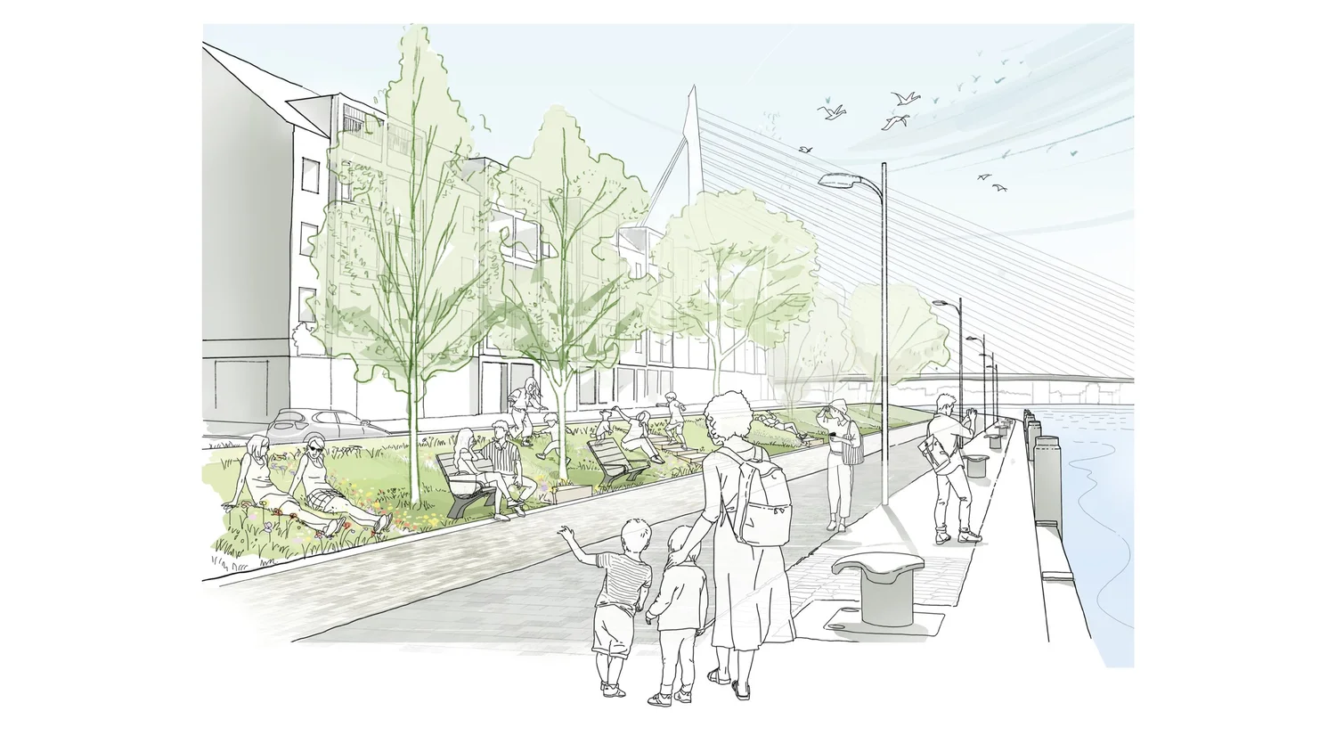
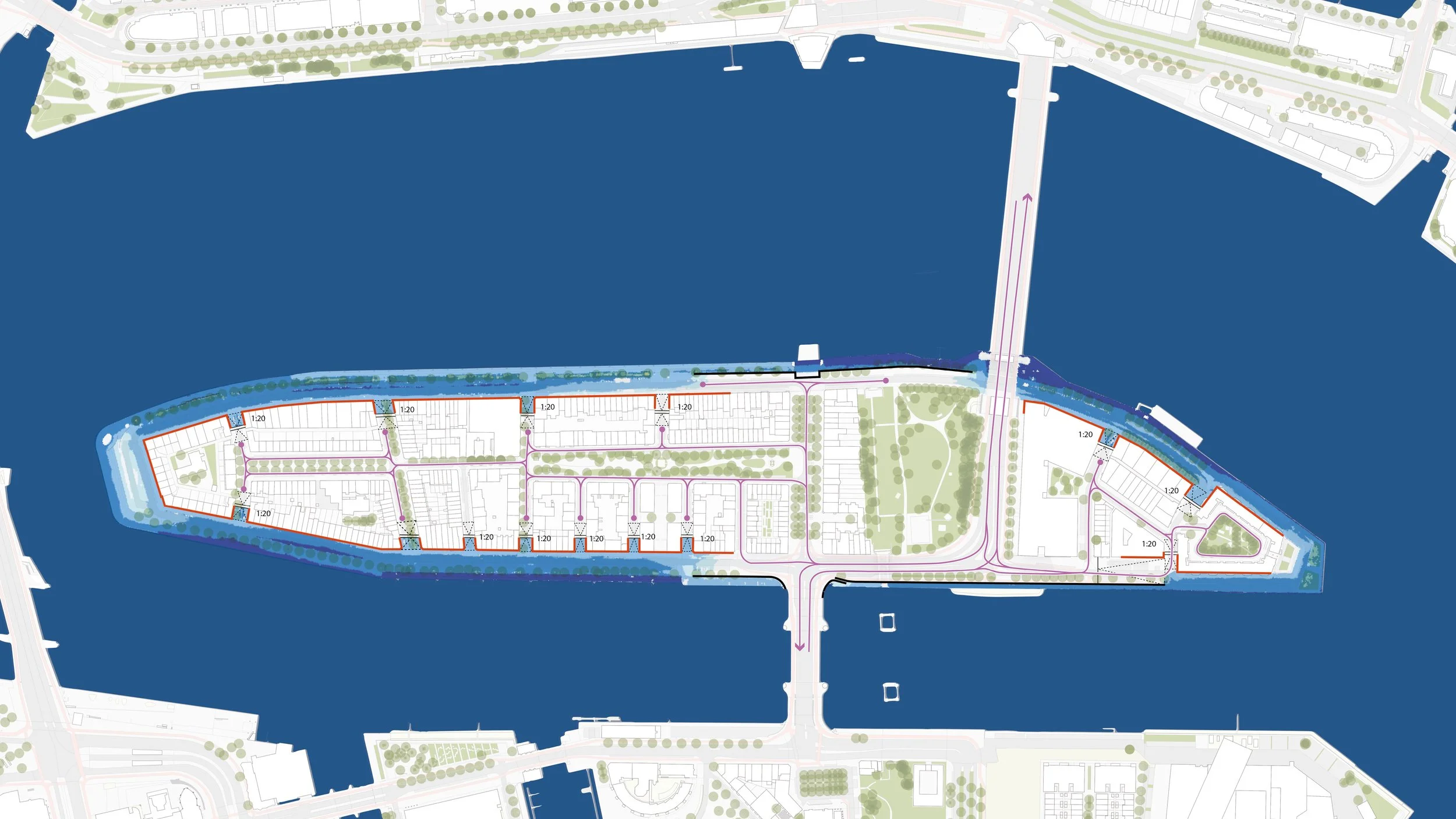
Low Dike Landscape
An alternative strategy introduces a low dike encircling the island. A maximum outer slope of 1:6 ensures accessibility and usability, transforming the dike into a public landscape rather than a barrier. Where existing trees are present, steeper slopes are applied locally to preserve the established vegetation.
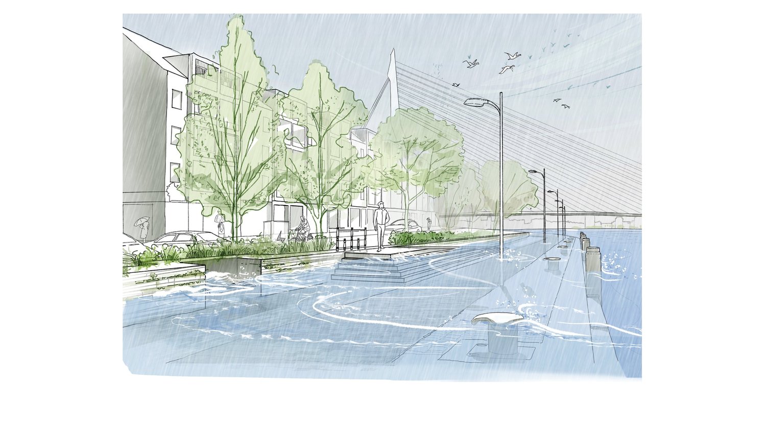
Building-Based Adaptation
A third strategy accepts periodic flooding of the quays while preventing water from entering the island’s interior. Individual buildings along the waterfront are waterproofed, and entrances are redesigned with ramps and thresholds. This approach minimises interventions in public space but shifts responsibility for flood resilience to individual property owners.