The New Meadowlands
New Jersey
Location | New Jersey, United States of America
Year | 2013 - 2014
Client | U.S department of Housing and Urban Development (HUD)
Collaboration | MIT_CAU, ZUS, Deltares, 75B, Volker Infra design
Status | Winning proposal
The proposal offers primary protection against flooding. An elongated green infrastructure next-generation berm with occasional gates, along the edges of the Meadowlands and most of its developed areas will protect against flooding from surges coming in from the Atlantic Ocean. Within the protected area, several substantial fresh-water basins will absorb rainwater flooding, substantially reducing the stormwater runoff into sewer lines, and therefore almost eliminating local rainwater flooding from sewer overflow.
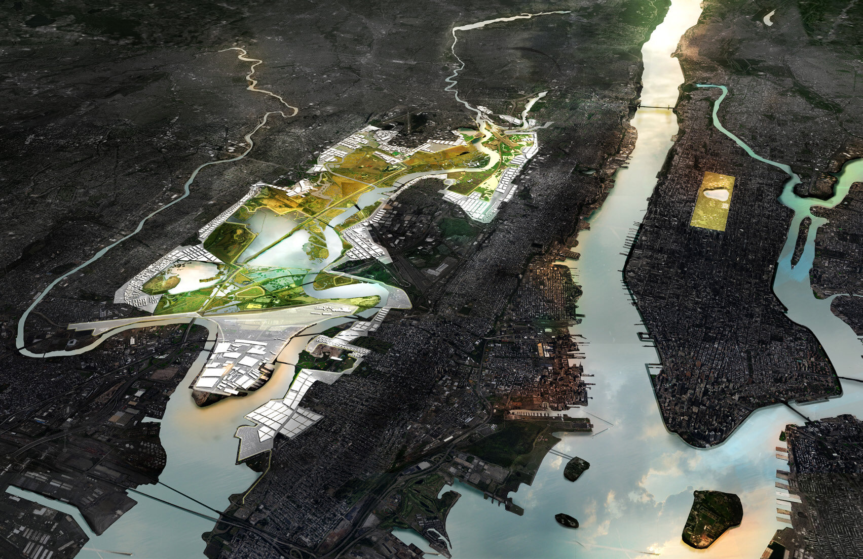
The New Meadowlands project articulates an integrated vision for protecting, connecting and growing this critical asset to both New Jersey and the metropolitan area of New York. The Meadowlands emerged out of a larger regional analysis that mapped a maximal spectrum of risks to a comprehensive set of vulnerabilities, combining flood risk with social vulnerability, vital network vulnerability, pollution risk, etc. Wherever this hazard sandwich reaches its greatest thickness, federal investments in protection make most sense. This analysis highlights the Meadowlands area as an urgent priority (see phase 2 of Rebuild by design).

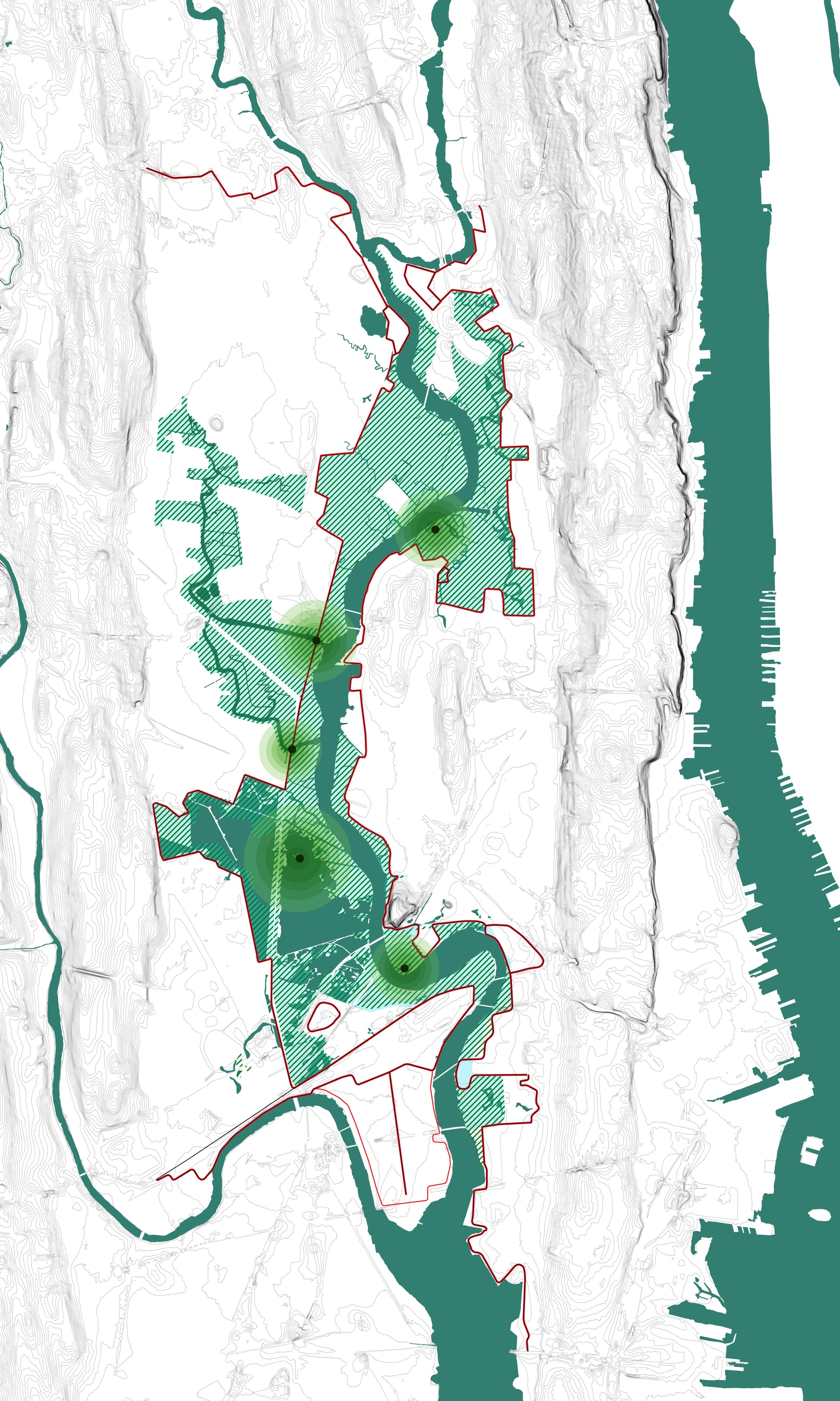
Towards a delta of resilience districts

The origin of today's territorial shape

Flood patterns

Expected flood issues in 2100

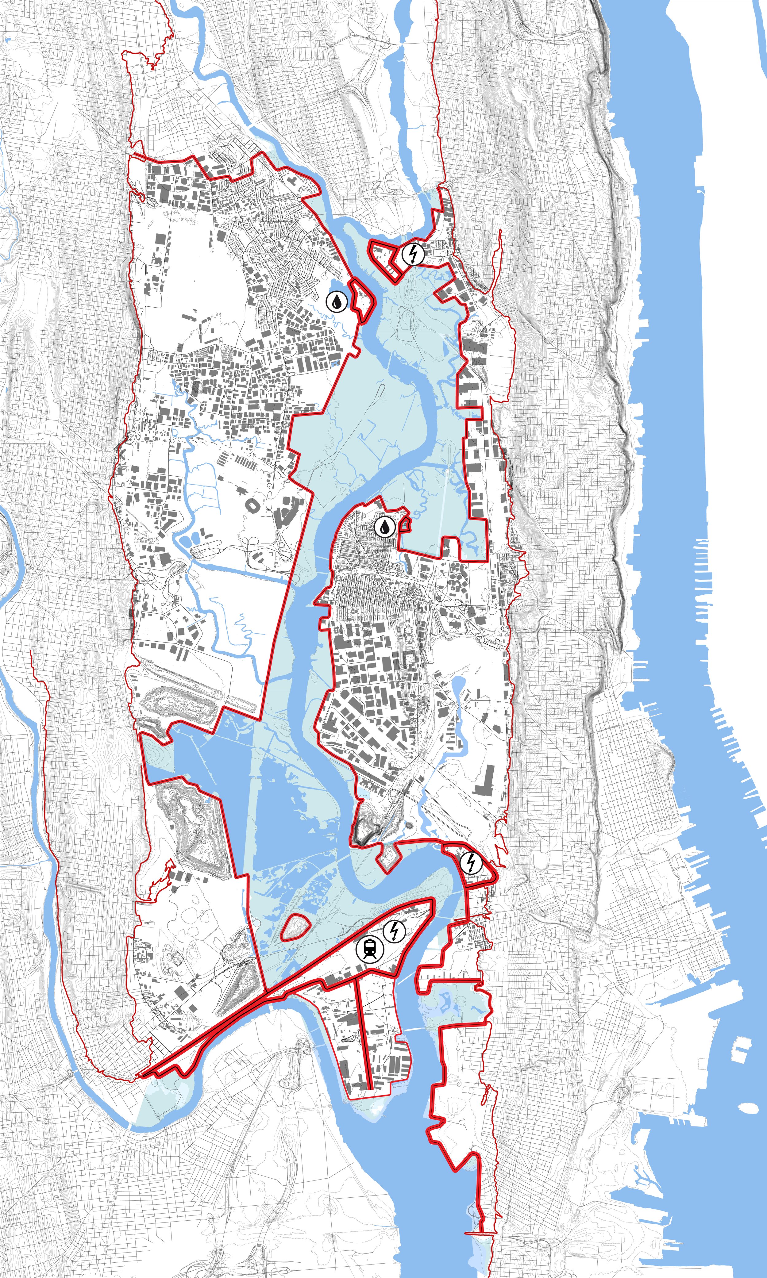
Multiple vulnerabilities overlap on flood risk layer

Case study: area where multiple risks come together

Absolutely critical is design integration. Designing both systems in full integration with other parts of the area (transportation, ecology, development) will bring benefits to both wildlife ecology and economic development that otherwise remain unaccounted for. Integrated design will allow for the various past and ongoing marshland restoration efforts by the Meadowlands Commission to become connected and legible as one large, regional wildlife refuge, to be made accessible at appropriate places for visitors. We propose to call this the MEADOWPARK. Integrated design will also allow for this large reserve to act as a major value adder and opportunity for the surrounding development areas. We propose to call the key element to this integrated design the MEADOWBAND. The Meadowband is a civic amenity consisting of a local street, a Bus Rapid Transit-line, and a string of public spaces, recreation zones, and wildlife reserve access points on top of the outer berm and its slopes.

The Meadowband is the missing link in the Meadowlands basin: a public space that mediates between the different systems (ecology, development) and the different scales (very local to interstate). In doing so, it provides a critical connective tissue on the scale of the Meadowlands itself – literally taking on the scale of the protection infrastructure. We envision that the audience for this linear, meandering amenity consists of the inhabitants of the existing towns, the residents in new residential developments aligning the Meadowband, as well as tourists and visitors from the region, seeking access and recreation at what will be its biggest regional park


In order to be worthy of substantial federal investment in protecting land from future flooding, it is imperative to use that land more effectively. That means we propose shifting from a suburban-type land-use zoning (single story, freestanding, open-space parking around structure), to a more urban-type land-use zoning. Single-story warehouse zones should be up-zoned to become multi-story; areas around the Meadowband would be zoned to include multi-story residential opportunities. Development footprints along the Meadowband can become smaller in plan, and taller in section. These decisions over time will enhance the brand and identity of the basin, drive up the value of the land, and the ratable tax returns for the towns concerned.
The flood protection system: Berm System
Wetland system
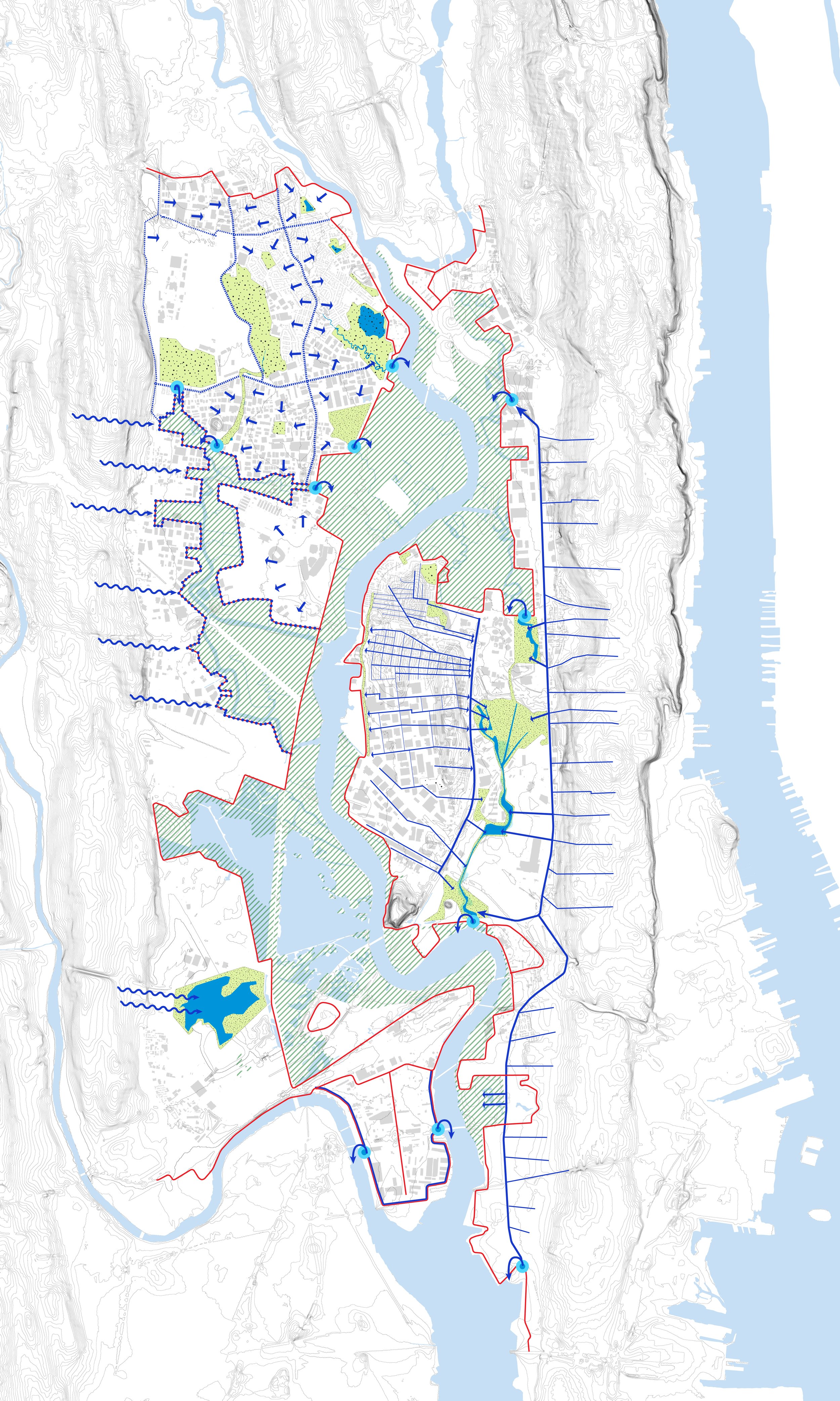
Rainwater system

The ecosystem of the Meadowpark

The biodiversity of the Meadowpark

Protect system the Meadowpark

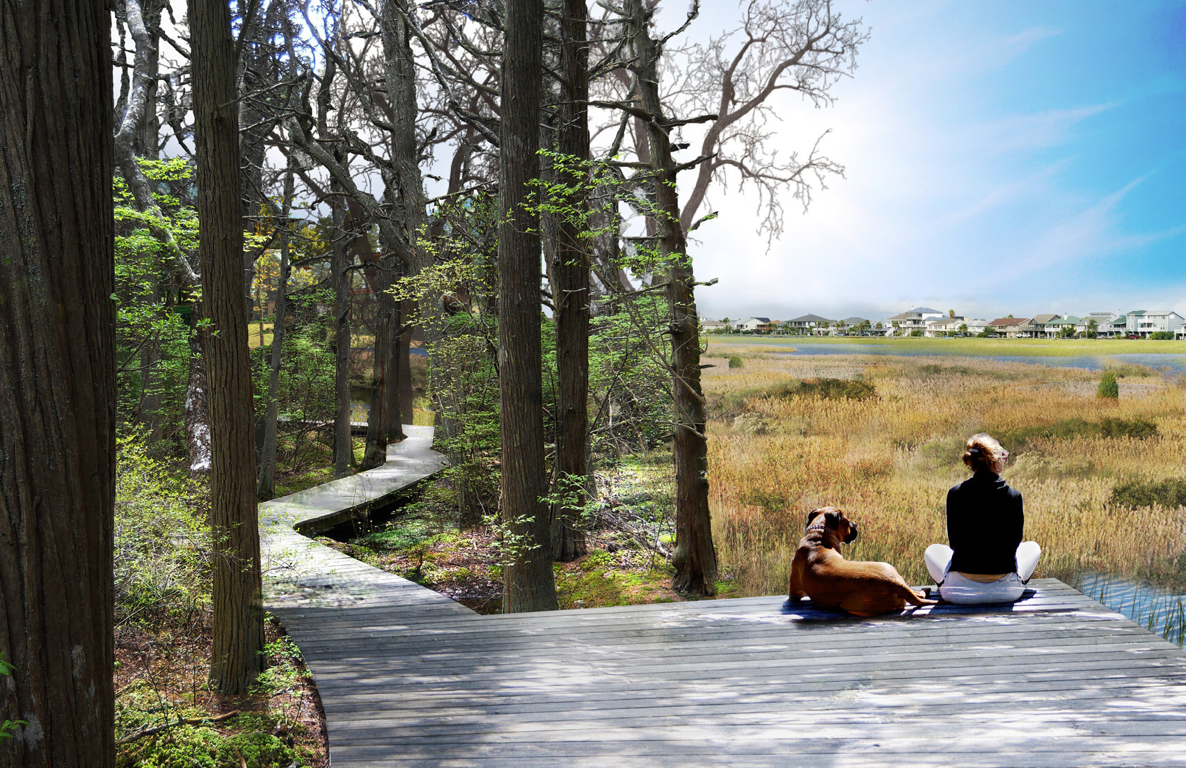
A place to recreate
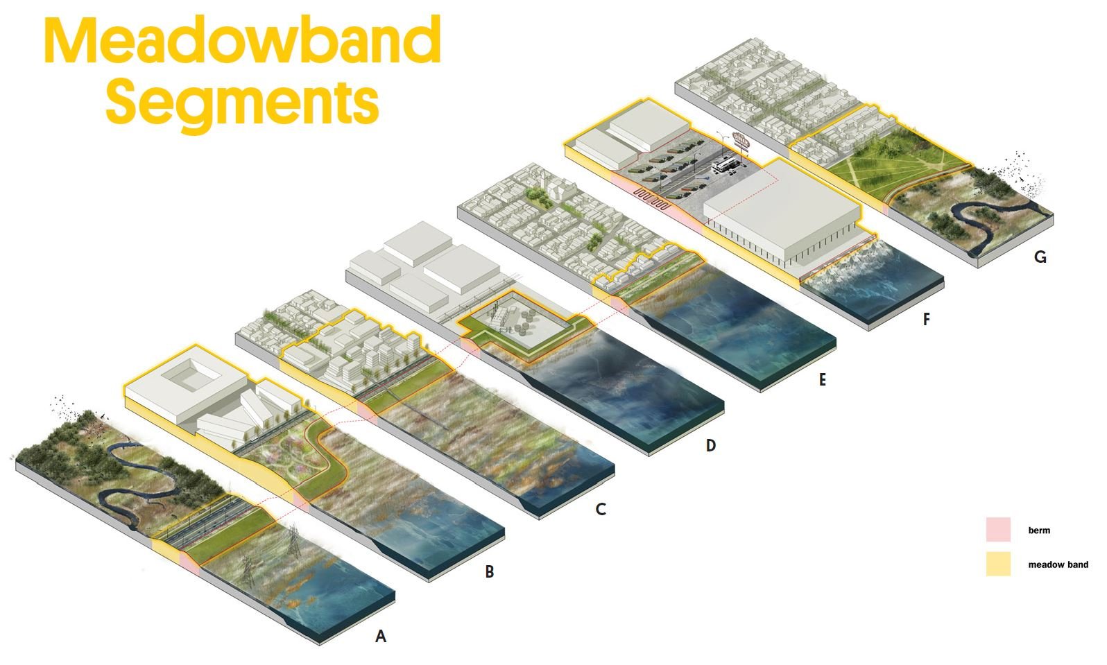
Connect + Grow: The Meadowband segments

Connect the Meadowband

New waterfront on the Hackensack river

Wet fresh forest park