
Climateproof Zaan/IJ-Banks
Amsterdam, The Netherlands
Location | Amsterdam & Zaanstad, The Netherlands
Year | 2012
Client | Ministry of Infrastructure and Environment (I&M)
Sparring Partners | Waternet, DRO Amsterdam, City of Zaanstad & Waterborough Hollands Noorderkwartier; workshops: STOWA, HKV, Deltares, TNO, Province of Noord Holland
Status | Explorative study (“Proeftuin”), follow-up to Waterproof Amsterdam
Climate proof Zaan/IJ-banks is our follow up of “Waterproof Amsterdam”. In an explorative study DE URBANISTEN zoomed in on one of the two special locations we determined: Zaan/IJ-banks. This area is part of the ambitious Amsterdam waterfront development that stretches from IJ-burg in the east to Zaanstad in the west.
This area is part of the ambitious Amsterdam waterfront development that stretches from IJ-burg in the east to Zaanstad in the west. The western part is a very mixed use area: from the high end MTV headquarters to second hand car repair shops and from a bustling concentration of creative startups to the prestigious landmark of the ‘Eye’ film museum. This is a diverse quality to be cherished. At the same time a transformation of a large part of old industrial areas into new urban quarters is foreseen.
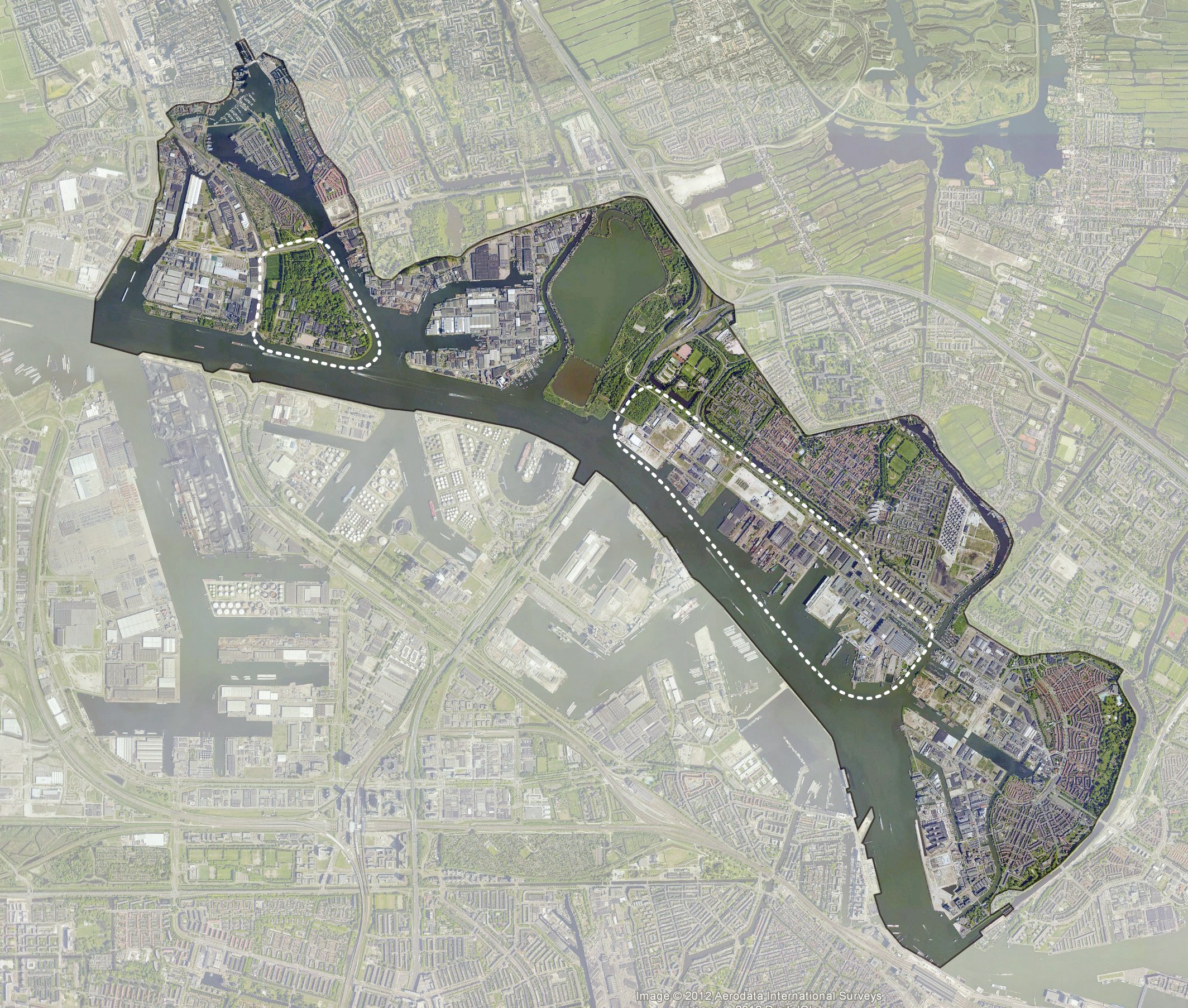
Study site Zaan/IJ-Banks
We started to examine the area from the viewpoint of water safety. We discovered that in relation to cost effectiveness it will not suffice to solely focus on waterproofing Zaan/IJ-banks in order to integrate adaptive measurements into future developments. In workshops with the involved governmental and knowledge partners we explored fruitful combinations with other climate issues that have to be solved in the area. It turned out to be more than interesting to combine cleaning polluted soil, rainproofing and floodproofing into one smart strategy for climateproofing the area. Simultaneously the spatial ambitions that have been defined in the regional vision (MIRT Zaan-IJ) are supported by this climateproof strategy.
Elaborate exchange scheme on NDSM - Wharf
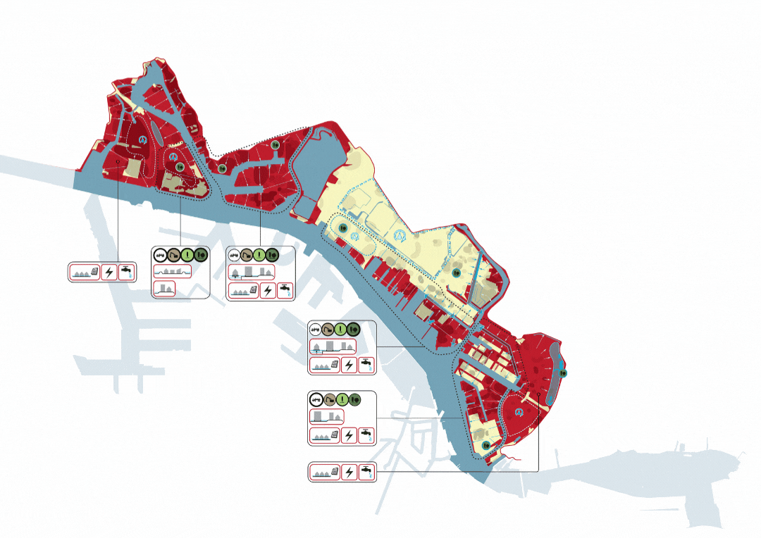
Adaptation Measurements are related to expected levels of inundation

Soil pollution can be treated in relation to future development expectations

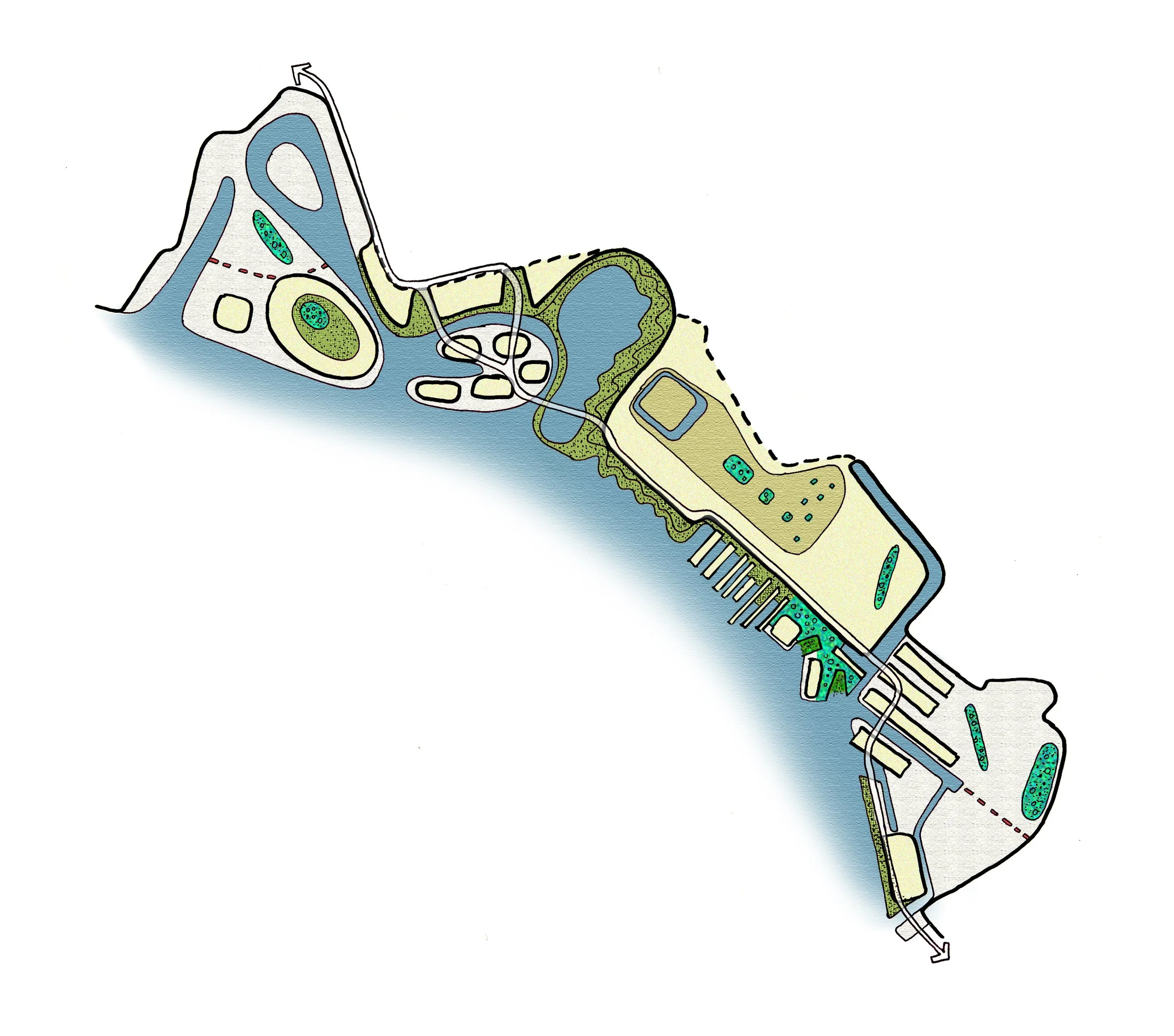
Speculative plan image 2050

Zooms on NDSM Wharf section
Covering areas with imported clean soil is an immediate floodproof strategy, but also very expensive. Taking more time to clean biologically is a way to create new green areas and preinvest in green structures and save money at the same time. If we smartly move polluted soil within the study area, we can floodproof and biologically clean at the same time. Furthermore we propose to sometimes dig out undeep polluted locations to reveal clean soil layers. Here we deliberately create the necessity for adaptive measurements to strengthen a water related characteristic for the site. This is the case for a part of NDSM terrain, where we propose a closer relationship to the IJ and to use a part of the area for rainwater collection at the same time. Wet green typologies and the ‘waterpark’, a new public space typology on the old ship wharf, create a dynamic character. With the changing of the weather, the waterpark will change its appearance as well as its potential for urban activities.

Possible situation 2050
Overall climateproofing Zaan/IJ-banks combines different civil engineering interventions into a spatial strategy that strengthens and diversifies the relationship between the land and the water of the IJ. New developments profit from this relationship and within the different areas a myriad of spatial water relations, adaptive building typologies, new green public spaces and bank typologies emerge. This is also expressed in the proposal for a new main recreational bike route from Amsterdam Central to the centre of Zaanstad along the banks of the IJ and Zaan.

Waterpark NDSM during dry weather & low water level

Waterpark NDSM during rainy weather & high water level

Waterpark NDSM during cloudburst & extreme water level
